Wangcao geodata
Wangcao (Guizhou) is a seat of a fourth-order administrative division; located in China in Asia/Shanghai (GMT+8) time zone. In our database, there are 1268 cities with bigger population. Compared to other cities in China, 73.1% of cities are located further ↑North; 82.9% of cities are located further →East and 80% of cities have lower elevation than Wangcao. Note1


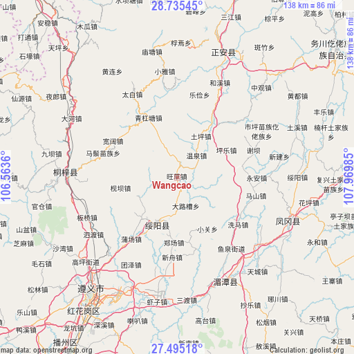
Wangcao GPS coordinates[2]
28° 7' 1.596" North, 107° 16' 0.192" East
| Map corner | latitude | longitude |
|---|---|---|
| Upper-left | 28.73545°, | 106.5636° |
| Center: | 28.11711°, | 107.26672° |
| Lower-right: | 27.49518°, | 107.96985° |
| Map W x H: | 137.9×137.9 km | = 85.7×85.7mi |
| max Lat: | 53.31946° ⇑73.1% North |
| Wangcao: | 28.11711° |
| min Lat: | ⇓26.9% South 18.22056° |
| min Long | Wangcao | max Long |
| 75.07348° | 107.26672° | 134.28917° |
| W 17.1%⇐ | ⇒82.9% E |
Elevation
Elevation of Wangcao is 695 m = 2280 ft, and this is 210.2 m = 690 ft above average elevation for this country.
| Max E: |
5622 m = 18445 ft | 20% |
| Wangcao | 695 m 2280 ft | |
| Avg. | 484.8 m = 1591 ft | |
Min E: |
-3 m = -10 ft | 80% |
See also: China elevation on elevation.city.
Geographical zone
Wangcao is located in North temperate zone (between Tropic of Cancer and the Arctic Circle). Distance of this Northern Tropic circle is 520.4 km =323.4 mi to South.| Distance of | km | miles | from Wangcao |
|---|---|---|---|
| North Pole | 6880.7 | 4275.5 | to North |
| Arctic Circle | 4274.8 | 2656.2 | to North |
| Tropic Cancer | 520.4 | 323.4 | to South |
| Equator | 3126.3 | 1942.6 | to South |


Nearby cities:
15 places around Wangcao: (largest is in red/bold)
• Dalucao
11.6 km =7.2 mi,  163°
163°
• Fuxing
36.4 km =22.6 mi,  111°
111°
• Huangyang
27.4 km =17 mi,  316°
316°
• Jianba
22.5 km =14 mi,  259°
259°
• Lejian
33.2 km =20.6 mi,  15°
15°
• Liudu
31.8 km =19.8 mi,  47°
47°
• Maoya
10.3 km =6.4 mi, 255°
• Mashan
31.5 km =19.6 mi,  103°
103°
• Pingle
21.9 km =13.6 mi,  60°
60°
• Taibai
36.9 km =22.9 mi,  331°
331°
• Tuping
18.9 km =11.7 mi,  29°
29°
• Wenquan
12.2 km =7.6 mi,  39°
39°
• Xieba
31.2 km =19.4 mi,  70°
70°
• Xihe
26.3 km =16.3 mi,  81°
81°
• Yong’an
30.9 km =19.2 mi,  90°
90°
Sources, notices
• [Note1] Compared only with cities in China existing in our database
• [Src1] Map data: © OpenStreetMap contributors (CC-BY-SA)
• [Src2] Other city data from geonames.org with taken over terms of usage.
• [Src3] Geographical zone / Annual Mean Temperature by Robert A. Rohde @ Wikipedia
