Wangbuzhuang geodata
Wangbuzhuang (Tianjin) is a populated place; located in China in Asia/Shanghai (GMT+8) time zone. With population of 2,659 people, there are 972 cities with bigger population in this country. Compared to other cities in China, 85.2% of cities are located further ↓South; 68.4% of cities are located further ←West and 92.7% of cities have higher elevation than Wangbuzhuang. Note1


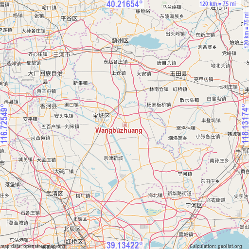
Wangbuzhuang GPS coordinates[2]
39° 40' 39" North, 117° 25' 42.996" East
| Map corner | latitude | longitude |
|---|---|---|
| Upper-left | 40.21654°, | 116.72549° |
| Center: | 39.6775°, | 117.42861° |
| Lower-right: | 39.13422°, | 118.13174° |
| Map W x H: | 120.3×120.3 km | = 74.8×74.8mi |
| max Lat: | 53.31946° ⇑14.8% North |
| Wangbuzhuang: | 39.6775° |
| min Lat: | ⇓85.2% South 18.22056° |
| min Long | Wangbuzhuang | max Long |
| 75.07348° | 117.42861° | 134.28917° |
| W 68.4%⇐ | ⇒31.6% E |
Elevation
Elevation of Wangbuzhuang is 8 m = 26 ft, and this is 476.8 m = 1564 ft below average elevation for this country.
| Max E: |
5622 m = 18445 ft | 92.7% |
| Avg. | 484.8 m = 1591 ft | |
| Wangbuzhuang | 8 m = 26 ft | |
Min E: |
-3 m = -10 ft | 7.3% |
See also: China elevation on elevation.city.
Geographical zone
Wangbuzhuang is located in North temperate zone (between Tropic of Cancer and the Arctic Circle). Distance of this Northern Tropic circle is 1805.8 km =1122.1 mi to South.| Distance of | km | miles | from Wangbuzhuang |
|---|---|---|---|
| North Pole | 5595.3 | 3476.8 | to North |
| Arctic Circle | 2989.4 | 1857.5 | to North |
| Tropic Cancer | 1805.8 | 1122.1 | to South |
| Equator | 4411.7 | 2741.3 | to South |


Nearby cities:
15 places around Wangbuzhuang: (largest is in red/bold)
• Beitan
9.1 km =5.7 mi,  9°
9°
• Dayanggezhuang
15.7 km =9.8 mi,  358°
358°
• Dazhongzhuang
11.6 km =7.2 mi,  88°
88°
• Fangjiazhuang
5.8 km =3.6 mi,  353°
353°
• Heilangkou
7.6 km =4.7 mi,  197°
197°
• Huogezhuang
9 km =5.6 mi,  324°
324°
• Lintingkou
8.1 km =5 mi,  130°
130°
• Majiadian
14.1 km =8.8 mi,  261°
261°
• Sanchakou
15.2 km =9.4 mi, 321°
• Shiqiao
11.4 km =7.1 mi,  277°
277°
• Xiacang
12.2 km =7.6 mi, 355°
• Xin’anzhen
12.2 km =7.6 mi,  47°
47°
• Yuguzhuang
7.3 km =4.5 mi,  235°
235°
• Zhongdeng
11.6 km =7.2 mi,  213°
213°
• Zhuangtou
11.9 km =7.4 mi, 259°
Sources, notices
• [Note1] Compared only with cities in China existing in our database
• [Src1] Map data: © OpenStreetMap contributors (CC-BY-SA)
• [Src2] Other city data from geonames.org with taken over terms of usage.
• [Src3] Geographical zone / Annual Mean Temperature by Robert A. Rohde @ Wikipedia
