Xin’anzhen geodata
Xin’anzhen (Tianjin) is a populated place; located in China in Asia/Shanghai (GMT+8) time zone. With population of 737 people, there are 1229 cities with bigger population in this country. Compared to other cities in China, 85.5% of cities are located further ↓South; 68.9% of cities are located further ←West and 98.3% of cities have higher elevation than Xin’anzhen. Note1


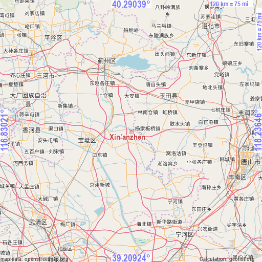
Xin’anzhen GPS coordinates[2]
39° 45' 6.984" North, 117° 31' 59.988" East
| Map corner | latitude | longitude |
|---|---|---|
| Upper-left | 40.29039°, | 116.83021° |
| Center: | 39.75194°, | 117.53333° |
| Lower-right: | 39.20924°, | 118.23646° |
| Map W x H: | 120.2×120.2 km | = 74.7×74.7mi |
| max Lat: | 53.31946° ⇑14.5% North |
| Xin’anzhen: | 39.75194° |
| min Lat: | ⇓85.5% South 18.22056° |
| min Long | Xin’anzhen | max Long |
| 75.07348° | 117.53333° | 134.28917° |
| W 68.9%⇐ | ⇒31.1% E |
Elevation
Elevation of Xin’anzhen is 4 m = 13 ft, and this is 480.8 m = 1577 ft below average elevation for this country.
| Max E: |
5622 m = 18445 ft | 98.3% |
| Avg. | 484.8 m = 1591 ft | |
| Xin’anzhen | 4 m = 13 ft | |
Min E: |
-3 m = -10 ft | 1.7% |
See also: China elevation on elevation.city.
Geographical zone
Xin’anzhen is located in North temperate zone (between Tropic of Cancer and the Arctic Circle). Distance of this Northern Tropic circle is 1814.1 km =1127.2 mi to South.| Distance of | km | miles | from Xin’anzhen |
|---|---|---|---|
| North Pole | 5587.1 | 3471.7 | to North |
| Arctic Circle | 2981.2 | 1852.4 | to North |
| Tropic Cancer | 1814.1 | 1127.2 | to South |
| Equator | 4420 | 2746.5 | to South |


Nearby cities:
15 places around Xin’anzhen: (largest is in red/bold)
• Beitan
7.5 km =4.7 mi,  275°
275°
• Dabao’anzhen
17.1 km =10.6 mi,  343°
343°
• Dahengshang
10.8 km =6.7 mi, 340°
• Dayanggezhuang
12 km =7.5 mi,  308°
308°
• Dazhongzhuang
8.3 km =5.2 mi,  161°
161°
• Fangjiazhuang
10 km =6.2 mi,  255°
255°
• Heilangkou
19.1 km =11.9 mi,  216°
216°
• Huogezhuang
14.2 km =8.8 mi,  266°
266°
• Lintingkou
13.8 km =8.6 mi,  191°
191°
• Mengquan
9.5 km =5.9 mi,  329°
329°
• Sanchakou
18.7 km =11.6 mi, 281°
• Wangbuzhuang
12.2 km =7.6 mi,  227°
227°
• Xiacang
10.7 km =6.6 mi,  291°
291°
• Yangjinzhuang
18.8 km =11.7 mi,  322°
322°
• Yuguzhuang
19.4 km =12.1 mi, 230°
Sources, notices
• [Note1] Compared only with cities in China existing in our database
• [Src1] Map data: © OpenStreetMap contributors (CC-BY-SA)
• [Src2] Other city data from geonames.org with taken over terms of usage.
• [Src3] Geographical zone / Annual Mean Temperature by Robert A. Rohde @ Wikipedia
