Yuguzhuang geodata
Yuguzhuang (Tianjin) is a populated place; located in China in Asia/Shanghai (GMT+8) time zone. With population of 1,442 people, there are 1101 cities with bigger population in this country. Compared to other cities in China, 85.1% of cities are located further ↓South; 68.1% of cities are located further ←West and 94.3% of cities have higher elevation than Yuguzhuang. Note1


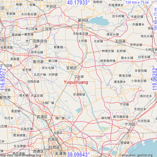
Yuguzhuang GPS coordinates[2]
39° 38' 24" North, 117° 21' 32.004" East
| Map corner | latitude | longitude |
|---|---|---|
| Upper-left | 40.17933°, | 116.65577° |
| Center: | 39.64°, | 117.35889° |
| Lower-right: | 39.09643°, | 118.06202° |
| Map W x H: | 120.4×120.4 km | = 74.8×74.8mi |
| max Lat: | 53.31946° ⇑14.9% North |
| Yuguzhuang: | 39.64° |
| min Lat: | ⇓85.1% South 18.22056° |
| min Long | Yuguzhuang | max Long |
| 75.07348° | 117.35889° | 134.28917° |
| W 68.1%⇐ | ⇒31.9% E |
Elevation
Elevation of Yuguzhuang is 7 m = 23 ft, and this is 477.8 m = 1568 ft below average elevation for this country.
| Max E: |
5622 m = 18445 ft | 94.3% |
| Avg. | 484.8 m = 1591 ft | |
| Yuguzhuang | 7 m = 23 ft | |
Min E: |
-3 m = -10 ft | 5.7% |
See also: China elevation on elevation.city.
Geographical zone
Yuguzhuang is located in North temperate zone (between Tropic of Cancer and the Arctic Circle). Distance of this Northern Tropic circle is 1801.6 km =1119.5 mi to South.| Distance of | km | miles | from Yuguzhuang |
|---|---|---|---|
| North Pole | 5599.5 | 3479.4 | to North |
| Arctic Circle | 2993.6 | 1860.1 | to North |
| Tropic Cancer | 1801.6 | 1119.5 | to South |
| Equator | 4407.6 | 2738.8 | to South |


Nearby cities:
15 places around Yuguzhuang: (largest is in red/bold)
• Beitan
15.1 km =9.4 mi,  29°
29°
• Dakoutun
12.8 km =8 mi,  240°
240°
• Fangjiazhuang
11.3 km =7 mi, 27°
• Heilangkou
4.8 km =3 mi,  129°
129°
• Huogezhuang
11.6 km =7.2 mi,  3°
3°
• Lintingkou
12.2 km =7.6 mi,  95°
95°
• Majiadian
8.2 km =5.1 mi,  283°
283°
• Nanrenfu
14.3 km =8.9 mi,  272°
272°
• Niujiapai
14.4 km =8.9 mi,  204°
204°
• Sanchakou
16.4 km =10.2 mi,  347°
347°
• Shiqiao
7.8 km =4.8 mi,  316°
316°
• Wangbuzhuang
7.3 km =4.5 mi,  55°
55°
• Xinkaikou
15.1 km =9.4 mi,  286°
286°
• Zhongdeng
5.5 km =3.4 mi,  185°
185°
• Zhuangtou
6.1 km =3.8 mi, 288°
Sources, notices
• [Note1] Compared only with cities in China existing in our database
• [Src1] Map data: © OpenStreetMap contributors (CC-BY-SA)
• [Src2] Other city data from geonames.org with taken over terms of usage.
• [Src3] Geographical zone / Annual Mean Temperature by Robert A. Rohde @ Wikipedia
