Wangbu geodata
Wangbu (Guangdong) is a seat of a fourth-order administrative division; located in China in Asia/Shanghai (GMT+8) time zone. In our database, there are 1268 cities with bigger population. Compared to other cities in China, 89.3% of cities are located further ↑North; 54.4% of cities are located further →East and 78.3% of cities have higher elevation than Wangbu. Note1


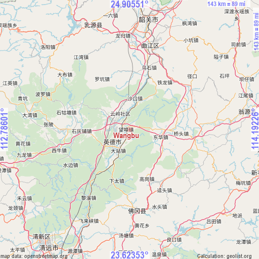
Wangbu GPS coordinates[2]
24° 15' 58.104" North, 113° 29' 20.868" East
| Map corner | latitude | longitude |
|---|---|---|
| Upper-left | 24.90551°, | 112.78601° |
| Center: | 24.26614°, | 113.48913° |
| Lower-right: | 23.62353°, | 114.19226° |
| Map W x H: | 142.5×142.5 km | = 88.5×88.5mi |
| max Lat: | 53.31946° ⇑89.3% North |
| Wangbu: | 24.26614° |
| min Lat: | ⇓10.7% South 18.22056° |
| min Long | Wangbu | max Long |
| 75.07348° | 113.48913° | 134.28917° |
| W 45.6%⇐ | ⇒54.4% E |
Elevation
Elevation of Wangbu is 30 m = 98 ft, and this is 454.8 m = 1492 ft below average elevation for this country.
| Max E: |
5622 m = 18445 ft | 78.3% |
| Avg. | 484.8 m = 1591 ft | |
| Wangbu | 30 m = 98 ft | |
Min E: |
-3 m = -10 ft | 21.7% |
See also: China elevation on elevation.city.
Geographical zone
Wangbu is located in North temperate zone (between Tropic of Cancer and the Arctic Circle). Distance of this Northern Tropic circle is 92.2 km =57.3 mi to South.| Distance of | km | miles | from Wangbu |
|---|---|---|---|
| North Pole | 7308.9 | 4541.5 | to North |
| Arctic Circle | 4703 | 2922.3 | to North |
| Tropic Cancer | 92.2 | 57.3 | to South |
| Equator | 2698.1 | 1676.5 | to South |


Nearby cities:
15 places around Wangbu: (largest is in red/bold)
• Dazhan
15.7 km =9.8 mi,  216°
216°
• Donghua
18.3 km =11.4 mi,  102°
102°
• Gaogang
28.8 km =17.9 mi,  161°
161°
• Hengshitang
15.3 km =9.5 mi,  305°
305°
• Huanggang
14.8 km =9.2 mi,  176°
176°
• Qiaotou
28.6 km =17.8 mi,  92°
92°
• Shakou
18.1 km =11.2 mi,  8°
8°
• Shihuipu
26.2 km =16.3 mi,  270°
270°
• Xiashitai
28.2 km =17.5 mi,  193°
193°
• Yingcheng
13.6 km =8.5 mi,  214°
214°
• Yingcheng
15.1 km =9.4 mi,  249°
249°
• Yinghong
9.1 km =5.7 mi,  293°
293°
• Yinghua
18.2 km =11.3 mi, 104°
• Yunling
10.3 km =6.4 mi,  330°
330°
• Yuwan
21.1 km =13.1 mi,  122°
122°
Sources, notices
• [Note1] Compared only with cities in China existing in our database
• [Src1] Map data: © OpenStreetMap contributors (CC-BY-SA)
• [Src2] Other city data from geonames.org with taken over terms of usage.
• [Src3] Geographical zone / Annual Mean Temperature by Robert A. Rohde @ Wikipedia
