Tiantang geodata
Tiantang (Shaanxi) is a seat of a fourth-order administrative division; located in China in Asia/Shanghai (GMT+8) time zone. In our database, there are 1268 cities with bigger population. Compared to other cities in China, 74.7% of cities are located further ↓South; 82% of cities are located further →East and 86.6% of cities have lower elevation than Tiantang. Note1


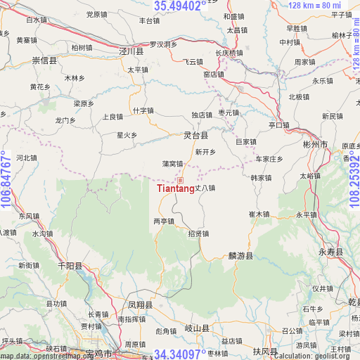
Tiantang GPS coordinates[2]
34° 55' 10.272" North, 107° 33' 2.844" East
| Map corner | latitude | longitude |
|---|---|---|
| Upper-left | 35.49402°, | 106.84767° |
| Center: | 34.91952°, | 107.55079° |
| Lower-right: | 34.34097°, | 108.25392° |
| Map W x H: | 128.2×128.2 km | = 79.7×79.7mi |
| max Lat: | 53.31946° ⇑25.3% North |
| Tiantang: | 34.91952° |
| min Lat: | ⇓74.7% South 18.22056° |
| min Long | Tiantang | max Long |
| 75.07348° | 107.55079° | 134.28917° |
| W 18%⇐ | ⇒82% E |
Elevation
Elevation of Tiantang is 1091 m = 3579 ft, and this is 606.2 m = 1989 ft above average elevation for this country.
| Max E: |
5622 m = 18445 ft | 13.4% |
| Tiantang | 1091 m 3579 ft | |
| Avg. | 484.8 m = 1591 ft | |
Min E: |
-3 m = -10 ft | 86.6% |
See also: China elevation on elevation.city.
Geographical zone
Tiantang is located in North temperate zone (between Tropic of Cancer and the Arctic Circle). Distance of this Northern Tropic circle is 1276.8 km =793.4 mi to South.| Distance of | km | miles | from Tiantang |
|---|---|---|---|
| North Pole | 6124.4 | 3805.5 | to North |
| Arctic Circle | 3518.5 | 2186.3 | to North |
| Tropic Cancer | 1276.8 | 793.4 | to South |
| Equator | 3882.7 | 2412.6 | to South |


Nearby cities:
15 places around Tiantang: (largest is in red/bold)
• Chejiazhuang
32.8 km =20.4 mi,  76°
76°
• Cuimu
30.6 km =19 mi,  113°
113°
• Didian
36.7 km =22.8 mi,  88°
88°
• Fanjiazhai
38.3 km =23.8 mi,  201°
201°
• Gaoya
21.7 km =13.5 mi,  263°
263°
• Hanjia
28.9 km =18 mi, 88°
• Hexi
22.5 km =14 mi, 82°
• Jiuchenggong
34.4 km =21.4 mi,  141°
141°
• Jiufang
18.6 km =11.6 mi,  231°
231°
• Liangting
15.6 km =9.7 mi, 200°
• Puwo
6.6 km =4.1 mi,  336°
336°
• Sangshuyuan
32 km =19.9 mi,  130°
130°
• Shaozhai
24.4 km =15.2 mi,  70°
70°
• Zhangba
9.2 km =5.7 mi, 106°
• Zhaoxian
20 km =12.4 mi,  160°
160°
Sources, notices
• [Note1] Compared only with cities in China existing in our database
• [Src1] Map data: © OpenStreetMap contributors (CC-BY-SA)
• [Src2] Other city data from geonames.org with taken over terms of usage.
• [Src3] Geographical zone / Annual Mean Temperature by Robert A. Rohde @ Wikipedia
