Puwo geodata
Puwo (Gansu) is a seat of a fourth-order administrative division; located in China in Asia/Shanghai (GMT+8) time zone. In our database, there are 1268 cities with bigger population. Compared to other cities in China, 74.9% of cities are located further ↓South; 82.1% of cities are located further →East and 89.9% of cities have lower elevation than Puwo. Note1


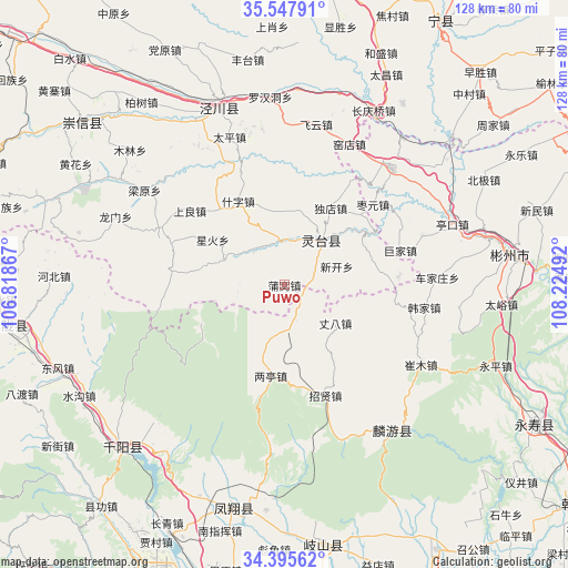
Puwo GPS coordinates[2]
34° 58' 25.644" North, 107° 31' 18.444" East
| Map corner | latitude | longitude |
|---|---|---|
| Upper-left | 35.54791°, | 106.81867° |
| Center: | 34.97379°, | 107.52179° |
| Lower-right: | 34.39562°, | 108.22492° |
| Map W x H: | 128.1×128.1 km | = 79.6×79.6mi |
| max Lat: | 53.31946° ⇑25.1% North |
| Puwo: | 34.97379° |
| min Lat: | ⇓74.9% South 18.22056° |
| min Long | Puwo | max Long |
| 75.07348° | 107.52179° | 134.28917° |
| W 17.9%⇐ | ⇒82.1% E |
Elevation
Elevation of Puwo is 1357 m = 4452 ft, and this is 872.2 m = 2862 ft above average elevation for this country.
| Max E: |
5622 m = 18445 ft | 10.1% |
| Puwo | 1357 m 4452 ft | |
| Avg. | 484.8 m = 1591 ft | |
Min E: |
-3 m = -10 ft | 89.9% |
See also: China elevation on elevation.city.
Geographical zone
Puwo is located in North temperate zone (between Tropic of Cancer and the Arctic Circle). Distance of this Northern Tropic circle is 1282.8 km =797.1 mi to South.| Distance of | km | miles | from Puwo |
|---|---|---|---|
| North Pole | 6118.3 | 3801.7 | to North |
| Arctic Circle | 3512.5 | 2182.6 | to North |
| Tropic Cancer | 1282.8 | 797.1 | to South |
| Equator | 3888.7 | 2416.3 | to South |


Nearby cities:
15 places around Puwo: (largest is in red/bold)
• Chejiazhuang
34.5 km =21.4 mi,  87°
87°
• Cuimu
35.7 km =22.2 mi,  120°
120°
• Didian
39.7 km =24.7 mi,  97°
97°
• Gaoya
20.8 km =12.9 mi,  245°
245°
• Hanjia
32 km =19.9 mi, 99°
• Hexi
25.1 km =15.6 mi, 97°
• Jiuchenggong
40.8 km =25.4 mi,  143°
143°
• Jiufang
21.3 km =13.2 mi,  213°
213°
• Liangting
20.8 km =12.9 mi,  188°
188°
• Sangshuyuan
38 km =23.6 mi,  134°
134°
• Shaozhai
25.8 km =16 mi, 85°
• Tiantang
6.6 km =4.1 mi,  156°
156°
• Zhangba
14.3 km =8.9 mi, 126°
• Zhaoren
35.7 km =22.2 mi,  43°
43°
• Zhaoxian
26.6 km =16.5 mi, 159°
Sources, notices
• [Note1] Compared only with cities in China existing in our database
• [Src1] Map data: © OpenStreetMap contributors (CC-BY-SA)
• [Src2] Other city data from geonames.org with taken over terms of usage.
• [Src3] Geographical zone / Annual Mean Temperature by Robert A. Rohde @ Wikipedia
