Fengshan geodata
Fengshan (Jiangxi) is a seat of a fourth-order administrative division; located in China in Asia/Shanghai (GMT+8) time zone. In our database, there are 1268 cities with bigger population. Compared to other cities in China, 80.7% of cities are located further ↑North; 62.7% of cities are located further ←West and 59.5% of cities have lower elevation than Fengshan. Note1


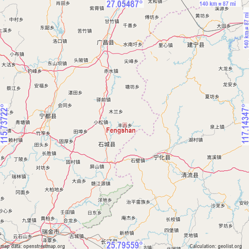
Fengshan GPS coordinates[2]
26° 25' 37.02" North, 116° 26' 25.224" East
| Map corner | latitude | longitude |
|---|---|---|
| Upper-left | 27.05487°, | 115.73722° |
| Center: | 26.42695°, | 116.44034° |
| Lower-right: | 25.79559°, | 117.14347° |
| Map W x H: | 140×140 km | = 87×87mi |
| max Lat: | 53.31946° ⇑80.7% North |
| Fengshan: | 26.42695° |
| min Lat: | ⇓19.3% South 18.22056° |
| min Long | Fengshan | max Long |
| 75.07348° | 116.44034° | 134.28917° |
| W 62.7%⇐ | ⇒37.3% E |
Elevation
Elevation of Fengshan is 254 m = 833 ft, and this is 230.8 m = 757 ft below average elevation for this country.
| Max E: |
5622 m = 18445 ft | 40.5% |
| Avg. | 484.8 m = 1591 ft | |
| Fengshan | 254 m = 833 ft | |
Min E: |
-3 m = -10 ft | 59.5% |
See also: China elevation on elevation.city.
Geographical zone
Fengshan is located in North temperate zone (between Tropic of Cancer and the Arctic Circle). Distance of this Northern Tropic circle is 332.5 km =206.6 mi to South.| Distance of | km | miles | from Fengshan |
|---|---|---|---|
| North Pole | 7068.7 | 4392.3 | to North |
| Arctic Circle | 4462.8 | 2773.1 | to North |
| Tropic Cancer | 332.5 | 206.6 | to South |
| Equator | 2938.4 | 1825.8 | to South |


Nearby cities:
15 places around Fengshan: (largest is in red/bold)
• Cuijiang
27.7 km =17.2 mi,  131°
131°
• Gaotian
5.7 km =3.5 mi,  30°
30°
• Helong
21.3 km =13.2 mi,  84°
84°
• Huaitu
26.3 km =16.3 mi,  173°
173°
• Mulan
9.2 km =5.7 mi,  326°
326°
• Pingshan
28 km =17.4 mi,  213°
213°
• Qinjiang
15.1 km =9.4 mi,  224°
224°
• Tangfang
22.1 km =13.7 mi,  11°
11°
• Tianbu
25.1 km =15.6 mi,  261°
261°
• Xiaosong
13.5 km =8.4 mi,  277°
277°
• Xinji
15.1 km =9.4 mi, 130°
• Xinshi
21.2 km =13.2 mi,  159°
159°
• Yangxi
22.2 km =13.8 mi,  347°
347°
• Yiqian
18.7 km =11.6 mi,  320°
320°
• Zhukeng
24.8 km =15.4 mi,  198°
198°
Sources, notices
• [Note1] Compared only with cities in China existing in our database
• [Src1] Map data: © OpenStreetMap contributors (CC-BY-SA)
• [Src2] Other city data from geonames.org with taken over terms of usage.
• [Src3] Geographical zone / Annual Mean Temperature by Robert A. Rohde @ Wikipedia
