Zuofang geodata
Zuofang (Jiangxi) is a seat of a fourth-order administrative division; located in China in Asia/Shanghai (GMT+8) time zone. In our database, there are 1268 cities with bigger population. Compared to other cities in China, 75.1% of cities are located further ↑North; 64.7% of cities are located further ←West and 63.1% of cities have higher elevation than Zuofang. Note1


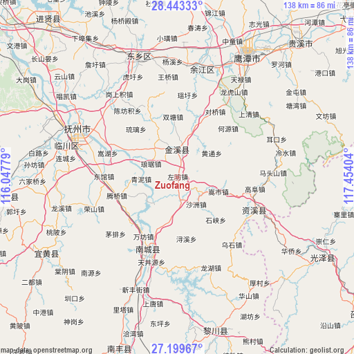
Zuofang GPS coordinates[2]
27° 49' 23.808" North, 116° 45' 3.276" East
| Map corner | latitude | longitude |
|---|---|---|
| Upper-left | 28.44333°, | 116.04779° |
| Center: | 27.82328°, | 116.75091° |
| Lower-right: | 27.19967°, | 117.45404° |
| Map W x H: | 138.3×138.3 km | = 85.9×85.9mi |
| max Lat: | 53.31946° ⇑75.1% North |
| Zuofang: | 27.82328° |
| min Lat: | ⇓24.9% South 18.22056° |
| min Long | Zuofang | max Long |
| 75.07348° | 116.75091° | 134.28917° |
| W 64.7%⇐ | ⇒35.3% E |
Elevation
Elevation of Zuofang is 82 m = 269 ft, and this is 402.8 m = 1322 ft below average elevation for this country.
| Max E: |
5622 m = 18445 ft | 63.1% |
| Avg. | 484.8 m = 1591 ft | |
| Zuofang | 82 m = 269 ft | |
Min E: |
-3 m = -10 ft | 36.9% |
See also: China elevation on elevation.city.
Geographical zone
Zuofang is located in North temperate zone (between Tropic of Cancer and the Arctic Circle). Distance of this Northern Tropic circle is 487.7 km =303 mi to South.| Distance of | km | miles | from Zuofang |
|---|---|---|---|
| North Pole | 6913.4 | 4295.8 | to North |
| Arctic Circle | 4307.5 | 2676.6 | to North |
| Tropic Cancer | 487.7 | 303 | to South |
| Equator | 3093.7 | 1922.3 | to South |


Nearby cities:
15 places around Zuofang: (largest is in red/bold)
• Dengfang
22.3 km =13.9 mi,  266°
266°
• Gaotian
11.7 km =7.3 mi,  125°
125°
• Heshi
24 km =14.9 mi,  335°
335°
• Heyuan
27.5 km =17.1 mi,  46°
46°
• Huwan
22.7 km =14.1 mi,  298°
298°
• Lufang
21.9 km =13.6 mi,  18°
18°
• Shazhou
12.8 km =8 mi,  144°
144°
• Shimen
10.3 km =6.4 mi,  241°
241°
• Shixia
22.4 km =13.9 mi, 138°
• Shuangtang
23.7 km =14.7 mi,  355°
355°
• Songshi
17 km =10.6 mi,  108°
108°
• Tengqiao
24.7 km =15.3 mi,  253°
253°
• Wanfang
26.6 km =16.5 mi,  209°
209°
• Xiugu
10.1 km =6.3 mi,  14°
14°
• Xujia
20.2 km =12.6 mi,  197°
197°
Sources, notices
• [Note1] Compared only with cities in China existing in our database
• [Src1] Map data: © OpenStreetMap contributors (CC-BY-SA)
• [Src2] Other city data from geonames.org with taken over terms of usage.
• [Src3] Geographical zone / Annual Mean Temperature by Robert A. Rohde @ Wikipedia
