Songyuan geodata
Songyuan (Zhejiang) is a seat of a third-order administrative division; located in China in Asia/Shanghai (GMT+8) time zone. In our database, there are 1268 cities with bigger population. Compared to other cities in China, 76.1% of cities are located further ↑North; 76.4% of cities are located further ←West and 67.1% of cities have lower elevation than Songyuan. Note1


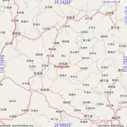
Songyuan GPS coordinates[2]
27° 37' 18.012" North, 119° 3' 33.012" East
| Map corner | latitude | longitude |
|---|---|---|
| Upper-left | 28.24288°, | 118.35605° |
| Center: | 27.62167°, | 119.05917° |
| Lower-right: | 26.99692°, | 119.7623° |
| Map W x H: | 138.5×138.5 km | = 86.1×86.1mi |
| max Lat: | 53.31946° ⇑76.1% North |
| Songyuan: | 27.62167° |
| min Lat: | ⇓23.9% South 18.22056° |
| min Long | Songyuan | max Long |
| 75.07348° | 119.05917° | 134.28917° |
| W 76.4%⇐ | ⇒23.6% E |
Elevation
Elevation of Songyuan is 361 m = 1184 ft, and this is 123.8 m = 406 ft below average elevation for this country.
| Max E: |
5622 m = 18445 ft | 32.9% |
| Avg. | 484.8 m = 1591 ft | |
| Songyuan | 361 m = 1184 ft | |
Min E: |
-3 m = -10 ft | 67.1% |
See also: China elevation on elevation.city.
Geographical zone
Songyuan is located in North temperate zone (between Tropic of Cancer and the Arctic Circle). Distance of this Northern Tropic circle is 465.3 km =289.1 mi to South.| Distance of | km | miles | from Songyuan |
|---|---|---|---|
| North Pole | 6935.8 | 4309.7 | to North |
| Arctic Circle | 4329.9 | 2690.5 | to North |
| Tropic Cancer | 465.3 | 289.1 | to South |
| Equator | 3071.2 | 1908.4 | to South |


Nearby cities:
15 places around Songyuan: (largest is in red/bold)
• Annan
12.7 km =7.9 mi,  181°
181°
• Baishanzu
17.3 km =10.7 mi,  42°
42°
• Jushui
18 km =11.2 mi,  141°
141°
• Lingtou
20 km =12.4 mi,  112°
112°
• Lingyao
18.3 km =11.4 mi,  204°
204°
• Longgong
18.5 km =11.5 mi,  217°
217°
• Pingdu
9.2 km =5.7 mi,  263°
263°
• Sanxi
8.3 km =5.2 mi,  2°
2°
• Sishan
8.6 km =5.3 mi, 0°
• Wudabao
11 km =6.8 mi,  98°
98°
• Xianliang
16.6 km =10.3 mi,  78°
78°
• Xibian
19.9 km =12.4 mi,  323°
323°
• Yushang
8.9 km =5.5 mi,  232°
232°
• Zhoukou
16.1 km =10 mi,  301°
301°
• Zhukou
16.5 km =10.3 mi, 300°
Sources, notices
• [Note1] Compared only with cities in China existing in our database
• [Src1] Map data: © OpenStreetMap contributors (CC-BY-SA)
• [Src2] Other city data from geonames.org with taken over terms of usage.
• [Src3] Geographical zone / Annual Mean Temperature by Robert A. Rohde @ Wikipedia
