Shoushan geodata
Shoushan (Fujian) is a populated place; located in China in Asia/Shanghai (GMT+8) time zone. With population of 1,470 people, there are 1093 cities with bigger population in this country. Compared to other cities in China, 78.7% of cities are located further ↑North; 76.9% of cities are located further ←West and 84.3% of cities have lower elevation than Shoushan. Note1


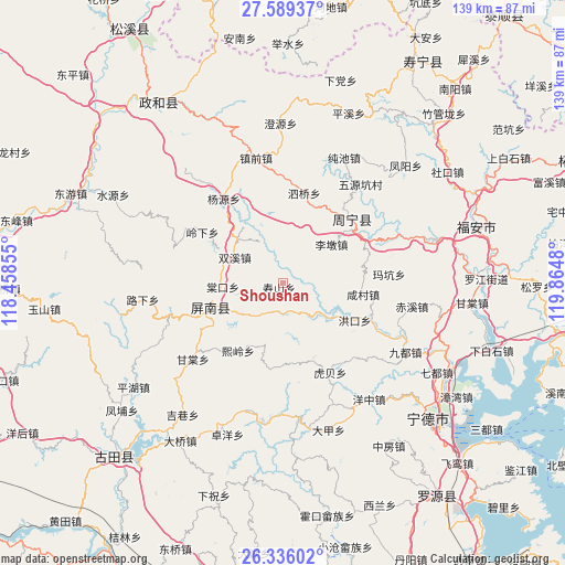
Shoushan GPS coordinates[2]
26° 57' 51.984" North, 119° 9' 42.012" East
| Map corner | latitude | longitude |
|---|---|---|
| Upper-left | 27.58937°, | 118.45855° |
| Center: | 26.96444°, | 119.16167° |
| Lower-right: | 26.33602°, | 119.8648° |
| Map W x H: | 139.4×139.4 km | = 86.6×86.6mi |
| max Lat: | 53.31946° ⇑78.7% North |
| Shoushan: | 26.96444° |
| min Lat: | ⇓21.3% South 18.22056° |
| min Long | Shoushan | max Long |
| 75.07348° | 119.16167° | 134.28917° |
| W 76.9%⇐ | ⇒23.1% E |
Elevation
Elevation of Shoushan is 940 m = 3084 ft, and this is 455.2 m = 1493 ft above average elevation for this country.
| Max E: |
5622 m = 18445 ft | 15.7% |
| Shoushan | 940 m 3084 ft | |
| Avg. | 484.8 m = 1591 ft | |
Min E: |
-3 m = -10 ft | 84.3% |
See also: China elevation on elevation.city.
Geographical zone
Shoushan is located in North temperate zone (between Tropic of Cancer and the Arctic Circle). Distance of this Northern Tropic circle is 392.2 km =243.7 mi to South.| Distance of | km | miles | from Shoushan |
|---|---|---|---|
| North Pole | 7008.9 | 4355.1 | to North |
| Arctic Circle | 4403 | 2735.9 | to North |
| Tropic Cancer | 392.2 | 243.7 | to South |
| Equator | 2998.2 | 1863 | to South |


Nearby cities:
15 places around Shoushan: (largest is in red/bold)
• Daixi
17.5 km =10.9 mi,  195°
195°
• Gufeng
18.9 km =11.7 mi,  250°
250°
• Huotong
28.4 km =17.6 mi,  116°
116°
• Lidun
15.3 km =9.5 mi,  50°
50°
• Limen
10.2 km =6.3 mi,  27°
27°
• Lingxia
23.6 km =14.7 mi,  302°
302°
• Puyuan
22 km =13.7 mi,  36°
36°
• Qibu
21.8 km =13.5 mi,  55°
55°
• Shuangxi
13.6 km =8.5 mi, 298°
• Siqiao
22.9 km =14.2 mi,  13°
13°
• Tangkou
14.8 km =9.2 mi,  265°
265°
• Xiancun
19.9 km =12.4 mi,  98°
98°
• Xiling
20.2 km =12.6 mi,  214°
214°
• Yangyuan
25.3 km =15.7 mi,  325°
325°
• Zhouning
23.3 km =14.5 mi, 47°
Sources, notices
• [Note1] Compared only with cities in China existing in our database
• [Src1] Map data: © OpenStreetMap contributors (CC-BY-SA)
• [Src2] Other city data from geonames.org with taken over terms of usage.
• [Src3] Geographical zone / Annual Mean Temperature by Robert A. Rohde @ Wikipedia
