Shilou geodata
Shilou (Guangdong) is a seat of a fourth-order administrative division; located in China in Asia/Shanghai (GMT+8) time zone. In our database, there are 1268 cities with bigger population. Compared to other cities in China, 94.6% of cities are located further ↑North; 54.4% of cities are located further →East and 92.7% of cities have higher elevation than Shilou. Note1


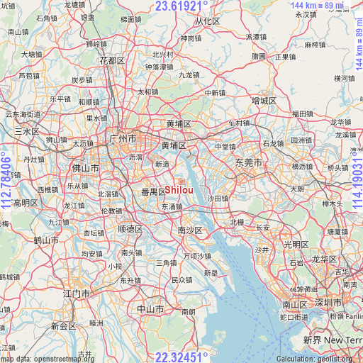
Shilou GPS coordinates[2]
22° 58' 24.276" North, 113° 29' 13.848" East
| Map corner | latitude | longitude |
|---|---|---|
| Upper-left | 23.61921°, | 112.78406° |
| Center: | 22.97341°, | 113.48718° |
| Lower-right: | 22.32451°, | 114.19031° |
| Map W x H: | 144×144 km | = 89.5×89.5mi |
| max Lat: | 53.31946° ⇑94.6% North |
| Shilou: | 22.97341° |
| min Lat: | ⇓5.4% South 18.22056° |
| min Long | Shilou | max Long |
| 75.07348° | 113.48718° | 134.28917° |
| W 45.6%⇐ | ⇒54.4% E |
Elevation
Elevation of Shilou is 8 m = 26 ft, and this is 476.8 m = 1564 ft below average elevation for this country.
| Max E: |
5622 m = 18445 ft | 92.7% |
| Avg. | 484.8 m = 1591 ft | |
| Shilou | 8 m = 26 ft | |
Min E: |
-3 m = -10 ft | 7.3% |
See also: China elevation on elevation.city.
Geographical zone
Shilou is located in North Torrid zone (between Equator and Tropic of Cancer). Distance of this Northern Tropic circle is 51.5 km =32 mi to North.| Distance of | km | miles | from Shilou |
|---|---|---|---|
| North Pole | 7452.7 | 4630.9 | to North |
| Arctic Circle | 4846.8 | 3011.7 | to North |
| Tropic Cancer | 51.5 | 32 | to North |
| Equator | 2554.4 | 1587.2 | to South |


Nearby cities:
15 places around Shilou: (largest is in red/bold)
• Changzhou
13.7 km =8.5 mi,  331°
331°
• Dalong
6.4 km =4 mi,  254°
254°
• Donghuan
12.6 km =7.8 mi,  255°
255°
• Dongyong
10.2 km =6.3 mi,  198°
198°
• Hongmei
12.1 km =7.5 mi,  79°
79°
• Hongshan
14.5 km =9 mi,  351°
351°
• Hualong
8.9 km =5.5 mi, 333°
• Mayong
12.4 km =7.7 mi,  41°
41°
• Nancun
11 km =6.8 mi,  294°
294°
• Qiaonan
13.5 km =8.4 mi, 246°
• Shatian
13.9 km =8.6 mi,  113°
113°
• Shiqi
5.8 km =3.6 mi, 251°
• Shiqiao
13.6 km =8.5 mi, 257°
• Suidong
12.5 km =7.8 mi,  9°
9°
• Xinzao
10.6 km =6.6 mi,  316°
316°
Sources, notices
• [Note1] Compared only with cities in China existing in our database
• [Src1] Map data: © OpenStreetMap contributors (CC-BY-SA)
• [Src2] Other city data from geonames.org with taken over terms of usage.
• [Src3] Geographical zone / Annual Mean Temperature by Robert A. Rohde @ Wikipedia
