Xianglong geodata
Xianglong (Chongqing) is a seat of a fourth-order administrative division; located in China in Asia/Shanghai (GMT+8) time zone. In our database, there are 1268 cities with bigger population. Compared to other cities in China, 51.6% of cities are located further ↑North; 84.9% of cities are located further →East and 63.4% of cities have lower elevation than Xianglong. Note1


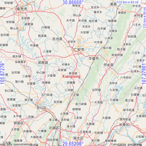
Xianglong GPS coordinates[2]
30° 15' 40.5" North, 106° 34' 33.168" East
| Map corner | latitude | longitude |
|---|---|---|
| Upper-left | 30.86668°, | 105.87276° |
| Center: | 30.26125°, | 106.57588° |
| Lower-right: | 29.65206°, | 107.27901° |
| Map W x H: | 135.1×135.1 km | = 83.9×83.9mi |
| max Lat: | 53.31946° ⇑51.6% North |
| Xianglong: | 30.26125° |
| min Lat: | ⇓48.4% South 18.22056° |
| min Long | Xianglong | max Long |
| 75.07348° | 106.57588° | 134.28917° |
| W 15.1%⇐ | ⇒84.9% E |
Elevation
Elevation of Xianglong is 303 m = 994 ft, and this is 181.8 m = 596 ft below average elevation for this country.
| Max E: |
5622 m = 18445 ft | 36.6% |
| Avg. | 484.8 m = 1591 ft | |
| Xianglong | 303 m = 994 ft | |
Min E: |
-3 m = -10 ft | 63.4% |
See also: China elevation on elevation.city.
Geographical zone
Xianglong is located in North temperate zone (between Tropic of Cancer and the Arctic Circle). Distance of this Northern Tropic circle is 758.8 km =471.5 mi to South.| Distance of | km | miles | from Xianglong |
|---|---|---|---|
| North Pole | 6642.3 | 4127.3 | to North |
| Arctic Circle | 4036.4 | 2508.1 | to North |
| Tropic Cancer | 758.8 | 471.5 | to South |
| Equator | 3364.7 | 2090.7 | to South |


Nearby cities:
15 places around Xianglong: (largest is in red/bold)
• Guandu
24.5 km =15.2 mi,  215°
215°
• Guang’an
24.4 km =15.2 mi,  13°
13°
• Jindaoxia
29.4 km =18.3 mi,  165°
165°
• Laitan
12.8 km =8 mi, 222°
• Longshi
12.5 km =7.8 mi,  245°
245°
• Qiantang
26.4 km =16.4 mi, 251°
• Sanhui
20 km =12.4 mi,  175°
175°
• Shayu
20.1 km =12.5 mi,  264°
264°
• Shitan
22.5 km =14 mi,  198°
198°
• Shuangfeng
30 km =18.6 mi,  207°
207°
• Shuanghejiedao
22.7 km =14.1 mi,  56°
56°
• Shuanghuai
8.8 km =5.5 mi,  192°
192°
• Xiaojia
10.6 km =6.6 mi,  286°
286°
• Xiaomian
15.9 km =9.9 mi, 194°
• Yankou
29.5 km =18.3 mi, 289°
Sources, notices
• [Note1] Compared only with cities in China existing in our database
• [Src1] Map data: © OpenStreetMap contributors (CC-BY-SA)
• [Src2] Other city data from geonames.org with taken over terms of usage.
• [Src3] Geographical zone / Annual Mean Temperature by Robert A. Rohde @ Wikipedia
