Shuangfeng geodata
Shuangfeng (Chongqing) is a seat of a fourth-order administrative division; located in China in Asia/Shanghai (GMT+8) time zone. In our database, there are 1268 cities with bigger population. Compared to other cities in China, 53.7% of cities are located further ↑North; 85.4% of cities are located further →East and 65% of cities have lower elevation than Shuangfeng. Note1


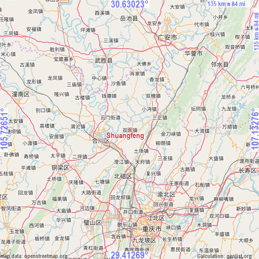
Shuangfeng GPS coordinates[2]
30° 1' 23.988" North, 106° 25' 46.668" East
| Map corner | latitude | longitude |
|---|---|---|
| Upper-left | 30.63023°, | 105.72651° |
| Center: | 30.02333°, | 106.42963° |
| Lower-right: | 29.41269°, | 107.13276° |
| Map W x H: | 135.4×135.4 km | = 84.1×84.1mi |
| max Lat: | 53.31946° ⇑53.7% North |
| Shuangfeng: | 30.02333° |
| min Lat: | ⇓46.3% South 18.22056° |
| min Long | Shuangfeng | max Long |
| 75.07348° | 106.42963° | 134.28917° |
| W 14.6%⇐ | ⇒85.4% E |
Elevation
Elevation of Shuangfeng is 326 m = 1070 ft, and this is 158.8 m = 521 ft below average elevation for this country.
| Max E: |
5622 m = 18445 ft | 35% |
| Avg. | 484.8 m = 1591 ft | |
| Shuangfeng | 326 m = 1070 ft | |
Min E: |
-3 m = -10 ft | 65% |
See also: China elevation on elevation.city.
Geographical zone
Shuangfeng is located in North temperate zone (between Tropic of Cancer and the Arctic Circle). Distance of this Northern Tropic circle is 732.4 km =455.1 mi to South.| Distance of | km | miles | from Shuangfeng |
|---|---|---|---|
| North Pole | 6668.8 | 4143.8 | to North |
| Arctic Circle | 4062.9 | 2524.6 | to North |
| Tropic Cancer | 732.4 | 455.1 | to South |
| Equator | 3338.3 | 2074.3 | to South |


Nearby cities:
15 places around Shuangfeng: (largest is in red/bold)
• Chengjiang
17.4 km =10.8 mi,  194°
194°
• Diaoyucheng
16 km =9.9 mi,  260°
260°
• Guandu
6.4 km =4 mi,  359°
359°
• Hechuan
16.3 km =10.1 mi, 257°
• Laitan
17.8 km =11.1 mi,  17°
17°
• Nanjin
16.4 km =10.2 mi,  254°
254°
• Qingping
10.2 km =6.3 mi,  120°
120°
• Sanhui
16.8 km =10.4 mi,  67°
67°
• Shitan
8.7 km =5.4 mi,  54°
54°
• Tianfu
17.9 km =11.1 mi,  158°
158°
• Tuchang
12.4 km =7.7 mi,  151°
151°
• Xiaomian
15 km =9.3 mi,  42°
42°
• Yangcheng
16.9 km =10.5 mi, 261°
• Yanjing
11.6 km =7.2 mi,  221°
221°
• Yunmen
12.1 km =7.5 mi,  302°
302°
Sources, notices
• [Note1] Compared only with cities in China existing in our database
• [Src1] Map data: © OpenStreetMap contributors (CC-BY-SA)
• [Src2] Other city data from geonames.org with taken over terms of usage.
• [Src3] Geographical zone / Annual Mean Temperature by Robert A. Rohde @ Wikipedia
