Shihuiqiao geodata
Shihuiqiao (Hubei) is a seat of a fourth-order administrative division; located in China in Asia/Shanghai (GMT+8) time zone. In our database, there are 1268 cities with bigger population. Compared to other cities in China, 50.8% of cities are located further ↓South; 61.3% of cities are located further →East and 75.3% of cities have higher elevation than Shihuiqiao. Note1


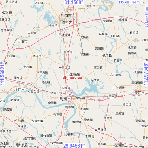
Shihuiqiao GPS coordinates[2]
30° 33' 11.484" North, 112° 16' 20.388" East
| Map corner | latitude | longitude |
|---|---|---|
| Upper-left | 31.1568°, | 111.56921° |
| Center: | 30.55319°, | 112.27233° |
| Lower-right: | 29.94581°, | 112.97546° |
| Map W x H: | 134.6×134.7 km | = 83.6×83.7mi |
| max Lat: | 53.31946° ⇑49.2% North |
| Shihuiqiao: | 30.55319° |
| min Lat: | ⇓50.8% South 18.22056° |
| min Long | Shihuiqiao | max Long |
| 75.07348° | 112.27233° | 134.28917° |
| W 38.7%⇐ | ⇒61.3% E |
Elevation
Elevation of Shihuiqiao is 36 m = 118 ft, and this is 448.8 m = 1472 ft below average elevation for this country.
| Max E: |
5622 m = 18445 ft | 75.3% |
| Avg. | 484.8 m = 1591 ft | |
| Shihuiqiao | 36 m = 118 ft | |
Min E: |
-3 m = -10 ft | 24.7% |
See also: China elevation on elevation.city.
Geographical zone
Shihuiqiao is located in North temperate zone (between Tropic of Cancer and the Arctic Circle). Distance of this Northern Tropic circle is 791.3 km =491.7 mi to South.| Distance of | km | miles | from Shihuiqiao |
|---|---|---|---|
| North Pole | 6609.9 | 4107.2 | to North |
| Arctic Circle | 4004 | 2488 | to North |
| Tropic Cancer | 791.3 | 491.7 | to South |
| Equator | 3397.2 | 2110.9 | to South |


Nearby cities:
15 places around Shihuiqiao: (largest is in red/bold)
• Chengnan
24.6 km =15.3 mi,  201°
201°
• Chuandian
19.5 km =12.1 mi,  282°
282°
• Dongcheng
23.9 km =14.9 mi, 199°
• Hougang
11.4 km =7.1 mi,  110°
110°
• Jinan
13.6 km =8.5 mi,  210°
210°
• Jingzhou
23.9 km =14.9 mi, 199°
• Jishan
9.3 km =5.8 mi,  260°
260°
• Luochang
22.3 km =13.9 mi,  164°
164°
• Maoli
19.8 km =12.3 mi, 105°
• Shashi
27.5 km =17.1 mi,  185°
185°
• Shilipu
10.8 km =6.7 mi,  305°
305°
• Wulipu
21.5 km =13.4 mi,  341°
341°
• Xicheng
23.3 km =14.5 mi, 202°
• Yingcheng
21.7 km =13.5 mi, 198°
• Zengji
20.8 km =12.9 mi,  26°
26°
Sources, notices
• [Note1] Compared only with cities in China existing in our database
• [Src1] Map data: © OpenStreetMap contributors (CC-BY-SA)
• [Src2] Other city data from geonames.org with taken over terms of usage.
• [Src3] Geographical zone / Annual Mean Temperature by Robert A. Rohde @ Wikipedia
