Maoli geodata
Maoli (Hubei) is a seat of a fourth-order administrative division; located in China in Asia/Shanghai (GMT+8) time zone. In our database, there are 1268 cities with bigger population. Compared to other cities in China, 50.4% of cities are located further ↓South; 60.2% of cities are located further →East and 73.7% of cities have higher elevation than Maoli. Note1


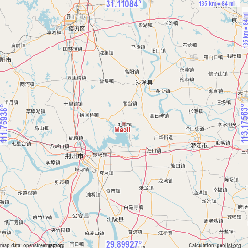
Maoli GPS coordinates[2]
30° 30' 24.984" North, 112° 28' 21" East
| Map corner | latitude | longitude |
|---|---|---|
| Upper-left | 31.11084°, | 111.76938° |
| Center: | 30.50694°, | 112.4725° |
| Lower-right: | 29.89927°, | 113.17563° |
| Map W x H: | 134.7×134.7 km | = 83.7×83.7mi |
| max Lat: | 53.31946° ⇑49.6% North |
| Maoli: | 30.50694° |
| min Lat: | ⇓50.4% South 18.22056° |
| min Long | Maoli | max Long |
| 75.07348° | 112.4725° | 134.28917° |
| W 39.8%⇐ | ⇒60.2% E |
Elevation
Elevation of Maoli is 40 m = 131 ft, and this is 444.8 m = 1459 ft below average elevation for this country.
| Max E: |
5622 m = 18445 ft | 73.7% |
| Avg. | 484.8 m = 1591 ft | |
| Maoli | 40 m = 131 ft | |
Min E: |
-3 m = -10 ft | 26.3% |
See also: China elevation on elevation.city.
Geographical zone
Maoli is located in North temperate zone (between Tropic of Cancer and the Arctic Circle). Distance of this Northern Tropic circle is 786.1 km =488.5 mi to South.| Distance of | km | miles | from Maoli |
|---|---|---|---|
| North Pole | 6615 | 4110.4 | to North |
| Arctic Circle | 4009.1 | 2491.1 | to North |
| Tropic Cancer | 786.1 | 488.5 | to South |
| Equator | 3392.1 | 2107.8 | to South |


Nearby cities:
15 places around Maoli: (largest is in red/bold)
• Cenhe
28 km =17.4 mi,  200°
200°
• Duobao
27.6 km =17.1 mi,  48°
48°
• Gaoshibei
19.5 km =12.1 mi,  75°
75°
• Guanghua
21.5 km =13.4 mi,  109°
109°
• Haokou
21.3 km =13.2 mi,  131°
131°
• Hougang
8.6 km =5.3 mi,  277°
277°
• Jinan
26.9 km =16.7 mi,  255°
255°
• Jishan
28.5 km =17.7 mi, 277°
• Jiyukou
12.7 km =7.9 mi,  116°
116°
• Lishi
12.9 km =8 mi,  44°
44°
• Luochang
21 km =13 mi,  218°
218°
• Shayang
25.1 km =15.6 mi,  26°
26°
• Shihuiqiao
19.8 km =12.3 mi,  285°
285°
• Wangchang
28.3 km =17.6 mi,  89°
89°
• Zengji
25.7 km =16 mi,  337°
337°
Sources, notices
• [Note1] Compared only with cities in China existing in our database
• [Src1] Map data: © OpenStreetMap contributors (CC-BY-SA)
• [Src2] Other city data from geonames.org with taken over terms of usage.
• [Src3] Geographical zone / Annual Mean Temperature by Robert A. Rohde @ Wikipedia
