Chuandian geodata
Chuandian (Hubei) is a seat of a fourth-order administrative division; located in China in Asia/Shanghai (GMT+8) time zone. In our database, there are 1268 cities with bigger population. Compared to other cities in China, 51% of cities are located further ↓South; 62.4% of cities are located further →East and 66.6% of cities have higher elevation than Chuandian. Note1


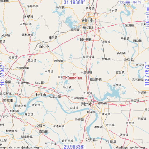
Chuandian GPS coordinates[2]
30° 35' 25.836" North, 112° 4' 24.924" East
| Map corner | latitude | longitude |
|---|---|---|
| Upper-left | 31.19388°, | 111.37047° |
| Center: | 30.59051°, | 112.07359° |
| Lower-right: | 29.98336°, | 112.77672° |
| Map W x H: | 134.6×134.6 km | = 83.6×83.6mi |
| max Lat: | 53.31946° ⇑49% North |
| Chuandian: | 30.59051° |
| min Lat: | ⇓51% South 18.22056° |
| min Long | Chuandian | max Long |
| 75.07348° | 112.07359° | 134.28917° |
| W 37.6%⇐ | ⇒62.4% E |
Elevation
Elevation of Chuandian is 66 m = 217 ft, and this is 418.8 m = 1374 ft below average elevation for this country.
| Max E: |
5622 m = 18445 ft | 66.6% |
| Avg. | 484.8 m = 1591 ft | |
| Chuandian | 66 m = 217 ft | |
Min E: |
-3 m = -10 ft | 33.4% |
See also: China elevation on elevation.city.
Geographical zone
Chuandian is located in North temperate zone (between Tropic of Cancer and the Arctic Circle). Distance of this Northern Tropic circle is 795.4 km =494.2 mi to South.| Distance of | km | miles | from Chuandian |
|---|---|---|---|
| North Pole | 6605.7 | 4104.6 | to North |
| Arctic Circle | 3999.8 | 2485.4 | to North |
| Tropic Cancer | 795.4 | 494.2 | to South |
| Equator | 3401.3 | 2113.5 | to South |


Nearby cities:
15 places around Chuandian: (largest is in red/bold)
• Banyue
23.7 km =14.7 mi,  277°
277°
• Chengnan
28.7 km =17.8 mi,  159°
159°
• Dongcheng
28.8 km =17.9 mi, 157°
• Herong
16.1 km =10 mi,  323°
323°
• Jinan
20 km =12.4 mi,  142°
142°
• Jingzhou
29 km =18 mi, 157°
• Jishan
11.4 km =7.1 mi,  119°
119°
• Lianghe
19.3 km =12 mi,  311°
311°
• Qixingtai
26.6 km =16.5 mi,  222°
222°
• Shihuiqiao
19.5 km =12.1 mi,  102°
102°
• Shilipu
10.5 km =6.5 mi,  78°
78°
• Wen’an
25.1 km =15.6 mi,  252°
252°
• Wulipu
20.3 km =12.6 mi,  36°
36°
• Xicheng
27.7 km =17.2 mi, 158°
• Yingcheng
27.5 km =17.1 mi,  153°
153°
Sources, notices
• [Note1] Compared only with cities in China existing in our database
• [Src1] Map data: © OpenStreetMap contributors (CC-BY-SA)
• [Src2] Other city data from geonames.org with taken over terms of usage.
• [Src3] Geographical zone / Annual Mean Temperature by Robert A. Rohde @ Wikipedia
