Shengjiaba geodata
Shengjiaba (Hubei) is a seat of a fourth-order administrative division; located in China in Asia/Shanghai (GMT+8) time zone. In our database, there are 1268 cities with bigger population. Compared to other cities in China, 54.2% of cities are located further ↑North; 75.3% of cities are located further →East and 82.5% of cities have lower elevation than Shengjiaba. Note1


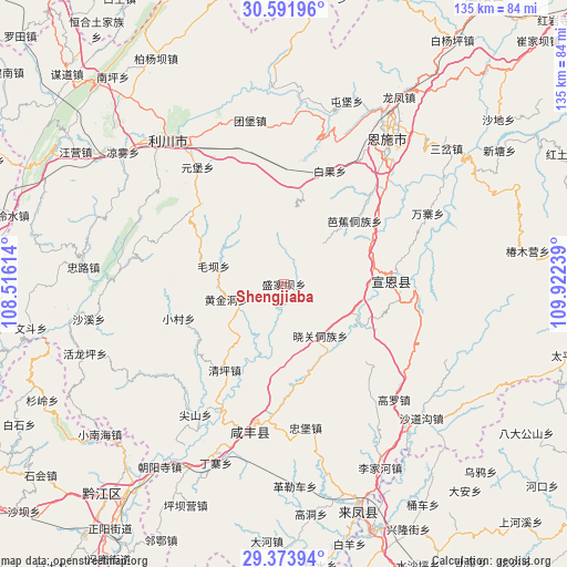
Shengjiaba GPS coordinates[2]
29° 59' 5.352" North, 109° 13' 9.336" East
| Map corner | latitude | longitude |
|---|---|---|
| Upper-left | 30.59196°, | 108.51614° |
| Center: | 29.98482°, | 109.21926° |
| Lower-right: | 29.37394°, | 109.92239° |
| Map W x H: | 135.4×135.4 km | = 84.1×84.1mi |
| max Lat: | 53.31946° ⇑54.2% North |
| Shengjiaba: | 29.98482° |
| min Lat: | ⇓45.8% South 18.22056° |
| min Long | Shengjiaba | max Long |
| 75.07348° | 109.21926° | 134.28917° |
| W 24.7%⇐ | ⇒75.3% E |
Elevation
Elevation of Shengjiaba is 818 m = 2684 ft, and this is 333.2 m = 1093 ft above average elevation for this country.
| Max E: |
5622 m = 18445 ft | 17.5% |
| Shengjiaba | 818 m 2684 ft | |
| Avg. | 484.8 m = 1591 ft | |
Min E: |
-3 m = -10 ft | 82.5% |
See also: China elevation on elevation.city.
Geographical zone
Shengjiaba is located in North temperate zone (between Tropic of Cancer and the Arctic Circle). Distance of this Northern Tropic circle is 728.1 km =452.4 mi to South.| Distance of | km | miles | from Shengjiaba |
|---|---|---|---|
| North Pole | 6673.1 | 4146.5 | to North |
| Arctic Circle | 4067.2 | 2527.2 | to North |
| Tropic Cancer | 728.1 | 452.4 | to South |
| Equator | 3334 | 2071.7 | to South |


Nearby cities:
15 places around Shengjiaba: (largest is in red/bold)
• Baiguo
29.1 km =18.1 mi,  22°
22°
• Gaoleshan
34.8 km =21.6 mi,  191°
191°
• Gaoluo
38.4 km =23.9 mi,  136°
136°
• Huangjindong
14.2 km =8.8 mi,  255°
255°
• Jianshan
37.9 km =23.5 mi,  214°
214°
• Jiaoyuan
21.8 km =13.5 mi,  79°
79°
• Liujiaoting
39.3 km =24.4 mi,  38°
38°
• Maoba
17.5 km =10.9 mi,  284°
284°
• Mingxing
34.2 km =21.3 mi,  171°
171°
• Qingshuitang
25.3 km =15.7 mi, 214°
• Wanzhai
38.3 km =23.8 mi,  63°
63°
• Xiaocun
26.6 km =16.5 mi,  252°
252°
• Xiaoguan
15.5 km =9.6 mi, 141°
• Yuanbao
34.7 km =21.6 mi,  323°
323°
• Zhushan
25 km =15.5 mi,  87°
87°
Sources, notices
• [Note1] Compared only with cities in China existing in our database
• [Src1] Map data: © OpenStreetMap contributors (CC-BY-SA)
• [Src2] Other city data from geonames.org with taken over terms of usage.
• [Src3] Geographical zone / Annual Mean Temperature by Robert A. Rohde @ Wikipedia
