Rensha geodata
Rensha (Chongqing) is a seat of a fourth-order administrative division; located in China in Asia/Shanghai (GMT+8) time zone. In our database, there are 1268 cities with bigger population. Compared to other cities in China, 53.5% of cities are located further ↑North; 81.9% of cities are located further →East and 54.3% of cities have lower elevation than Rensha. Note1


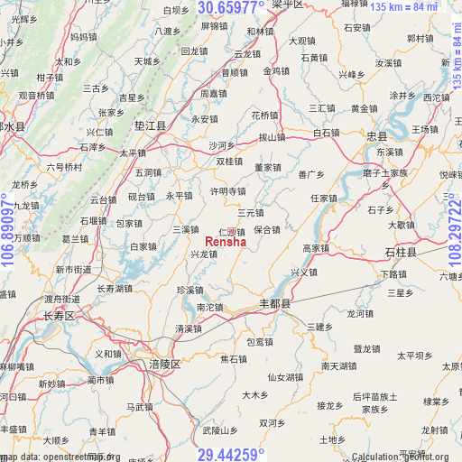
Rensha GPS coordinates[2]
30° 3' 10.98" North, 107° 35' 38.724" East
| Map corner | latitude | longitude |
|---|---|---|
| Upper-left | 30.65977°, | 106.89097° |
| Center: | 30.05305°, | 107.59409° |
| Lower-right: | 29.44259°, | 108.29722° |
| Map W x H: | 135.3×135.3 km | = 84.1×84.1mi |
| max Lat: | 53.31946° ⇑53.5% North |
| Rensha: | 30.05305° |
| min Lat: | ⇓46.5% South 18.22056° |
| min Long | Rensha | max Long |
| 75.07348° | 107.59409° | 134.28917° |
| W 18.1%⇐ | ⇒81.9% E |
Elevation
Elevation of Rensha is 200 m = 656 ft, and this is 284.8 m = 934 ft below average elevation for this country.
| Max E: |
5622 m = 18445 ft | 45.7% |
| Avg. | 484.8 m = 1591 ft | |
| Rensha | 200 m = 656 ft | |
Min E: |
-3 m = -10 ft | 54.3% |
See also: China elevation on elevation.city.
Geographical zone
Rensha is located in North temperate zone (between Tropic of Cancer and the Arctic Circle). Distance of this Northern Tropic circle is 735.7 km =457.1 mi to South.| Distance of | km | miles | from Rensha |
|---|---|---|---|
| North Pole | 6665.5 | 4141.7 | to North |
| Arctic Circle | 4059.6 | 2522.5 | to North |
| Tropic Cancer | 735.7 | 457.1 | to South |
| Equator | 3341.6 | 2076.4 | to South |


Nearby cities:
15 places around Rensha: (largest is in red/bold)
• Baohe
10.4 km =6.5 mi,  85°
85°
• Chongxing
10.4 km =6.5 mi,  231°
231°
• Dashi
17.2 km =10.7 mi,  341°
341°
• Gangjia
20.5 km =12.7 mi, 335°
• Huwei
16.9 km =10.5 mi,  165°
165°
• Peixing
10.9 km =6.8 mi,  317°
317°
• Pingshan
17 km =10.6 mi,  286°
286°
• Renyi
18.6 km =11.6 mi,  180°
180°
• Sanxi
13.6 km =8.5 mi,  275°
275°
• Sanyuan
8 km =5 mi,  44°
44°
• Shetan
7.4 km =4.6 mi,  164°
164°
• Shizhi
19.3 km =12 mi, 90°
• Shuanglongchang
15 km =9.3 mi,  54°
54°
• Shuren
15.8 km =9.8 mi,  117°
117°
• Xumingsi
12.2 km =7.6 mi,  354°
354°
Sources, notices
• [Note1] Compared only with cities in China existing in our database
• [Src1] Map data: © OpenStreetMap contributors (CC-BY-SA)
• [Src2] Other city data from geonames.org with taken over terms of usage.
• [Src3] Geographical zone / Annual Mean Temperature by Robert A. Rohde @ Wikipedia
