Ronglong geodata
Ronglong (Chongqing) is a seat of a fourth-order administrative division; located in China in Asia/Shanghai (GMT+8) time zone. In our database, there are 1268 cities with bigger population. Compared to other cities in China, 60.5% of cities are located further ↑North; 88.3% of cities are located further →East and 69.6% of cities have lower elevation than Ronglong. Note1


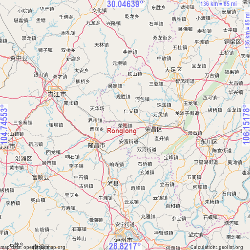
Ronglong GPS coordinates[2]
29° 26' 9.204" North, 105° 26' 55.14" East
| Map corner | latitude | longitude |
|---|---|---|
| Upper-left | 30.04639°, | 104.74553° |
| Center: | 29.43589°, | 105.44865° |
| Lower-right: | 28.8217°, | 106.15178° |
| Map W x H: | 136.2×136.2 km | = 84.6×84.6mi |
| max Lat: | 53.31946° ⇑60.5% North |
| Ronglong: | 29.43589° |
| min Lat: | ⇓39.5% South 18.22056° |
| min Long | Ronglong | max Long |
| 75.07348° | 105.44865° | 134.28917° |
| W 11.7%⇐ | ⇒88.3% E |
Elevation
Elevation of Ronglong is 403 m = 1322 ft, and this is 81.8 m = 268 ft below average elevation for this country.
| Max E: |
5622 m = 18445 ft | 30.4% |
| Avg. | 484.8 m = 1591 ft | |
| Ronglong | 403 m = 1322 ft | |
Min E: |
-3 m = -10 ft | 69.6% |
See also: China elevation on elevation.city.
Geographical zone
Ronglong is located in North temperate zone (between Tropic of Cancer and the Arctic Circle). Distance of this Northern Tropic circle is 667 km =414.5 mi to South.| Distance of | km | miles | from Ronglong |
|---|---|---|---|
| North Pole | 6734.1 | 4184.4 | to North |
| Arctic Circle | 4128.2 | 2565.1 | to North |
| Tropic Cancer | 667 | 414.5 | to South |
| Equator | 3273 | 2033.7 | to South |


Nearby cities:
15 places around Ronglong: (largest is in red/bold)
• Anfu
8.7 km =5.4 mi,  167°
167°
• Changyuan
14 km =8.7 mi,  104°
104°
• Guangshun
10.1 km =6.3 mi,  131°
131°
• Guansheng
15.8 km =9.8 mi,  356°
356°
• Guchang
14.7 km =9.1 mi,  67°
67°
• Hebao
17.1 km =10.6 mi,  32°
32°
• Jin’e
19 km =11.8 mi,  237°
237°
• Longji
5.1 km =3.2 mi,  304°
304°
• Panlong
10.4 km =6.5 mi,  313°
313°
• Qingjiang
17.1 km =10.6 mi, 171°
• Qingsheng
14.4 km =8.9 mi,  155°
155°
• Renyi
8.5 km =5.3 mi,  19°
19°
• Shuanghe
17.3 km =10.7 mi,  137°
137°
• Tonggu
19 km =11.8 mi,  5°
5°
• Yuanjue
18.6 km =11.6 mi,  316°
316°
Sources, notices
• [Note1] Compared only with cities in China existing in our database
• [Src1] Map data: © OpenStreetMap contributors (CC-BY-SA)
• [Src2] Other city data from geonames.org with taken over terms of usage.
• [Src3] Geographical zone / Annual Mean Temperature by Robert A. Rohde @ Wikipedia
