Jieyang geodata
Jieyang (Guangdong) is a seat of a second-order administrative division; located in China in Asia/Shanghai (GMT+8) time zone. With population of 1,001,985 people, there are 64 cities with bigger population in this country. Compared to other cities in China, 92% of cities are located further ↑North; 62.2% of cities are located further ←West and 94.3% of cities have higher elevation than Jieyang. Note1


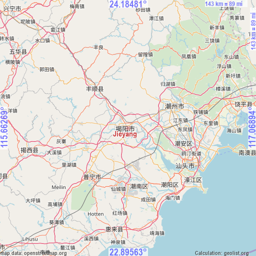
Jieyang GPS coordinates[2]
23° 32' 30.48" North, 116° 21' 56.916" East
| Map corner | latitude | longitude |
|---|---|---|
| Upper-left | 24.18481°, | 115.66269° |
| Center: | 23.5418°, | 116.36581° |
| Lower-right: | 22.89563°, | 117.06894° |
| Map W x H: | 143.3×143.3 km | = 89×89mi |
| max Lat: | 53.31946° ⇑92% North |
| Jieyang: | 23.5418° |
| min Lat: | ⇓8% South 18.22056° |
| min Long | Jieyang | max Long |
| 75.07348° | 116.36581° | 134.28917° |
| W 62.2%⇐ | ⇒37.8% E |
Elevation
Elevation of Jieyang is 7 m = 23 ft, and this is 477.8 m = 1568 ft below average elevation for this country.
| Max E: |
5622 m = 18445 ft | 94.3% |
| Avg. | 484.8 m = 1591 ft | |
| Jieyang | 7 m = 23 ft | |
Min E: |
-3 m = -10 ft | 5.7% |
See also: Jieyang elevation on elevation.city.
Geographical zone
Jieyang is located in North temperate zone (between Tropic of Cancer and the Arctic Circle). Distance of this Northern Tropic circle is 11.7 km =7.3 mi to South.| Distance of | km | miles | from Jieyang |
|---|---|---|---|
| North Pole | 7389.5 | 4591.6 | to North |
| Arctic Circle | 4783.6 | 2972.4 | to North |
| Tropic Cancer | 11.7 | 7.3 | to South |
| Equator | 2617.6 | 1626.5 | to South |


Nearby cities:
15 places around Jieyang: (largest is in red/bold)
• Denggang
15.3 km =9.5 mi,  88°
88°
• Guangtai
11.6 km =7.2 mi,  228°
228°
• Guiling
14 km =8.7 mi,  291°
291°
• Jinzao
10.1 km =6.3 mi,  165°
165°
• Linpan
13.3 km =8.3 mi,  276°
276°
• Meiyun
5.9 km =3.7 mi,  246°
246°
• Nanxi
13.5 km =8.4 mi, 252°
• Paotai
13.4 km =8.3 mi,  99°
99°
• Putian
8.6 km =5.3 mi,  15°
15°
• Quxi
7.5 km =4.7 mi,  63°
63°
• Xianqiao
5.3 km =3.3 mi,  200°
200°
• Xichang
8.9 km =5.5 mi,  332°
332°
• Xinheng
13.5 km =8.4 mi,  323°
323°
• Yuecheng
10.1 km =6.3 mi, 283°
• Yunlu
12.8 km =8 mi, 61°
Sources, notices
• [Note1] Compared only with cities in China existing in our database
• [Src1] Map data: © OpenStreetMap contributors (CC-BY-SA)
• [Src2] Other city data from geonames.org with taken over terms of usage.
• [Src3] Geographical zone / Annual Mean Temperature by Robert A. Rohde @ Wikipedia
