Renxian geodata
Renxian (Chongqing) is a seat of a fourth-order administrative division; located in China in Asia/Shanghai (GMT+8) time zone. In our database, there are 1268 cities with bigger population. Compared to other cities in China, 51.7% of cities are located further ↓South; 81.6% of cities are located further →East and 71.9% of cities have lower elevation than Renxian. Note1


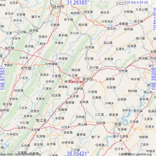
Renxian GPS coordinates[2]
30° 39' 39.312" North, 107° 40' 44.22" East
| Map corner | latitude | longitude |
|---|---|---|
| Upper-left | 31.26385°, | 106.97583° |
| Center: | 30.66092°, | 107.67895° |
| Lower-right: | 30.05421°, | 108.38208° |
| Map W x H: | 134.5×134.5 km | = 83.6×83.6mi |
| max Lat: | 53.31946° ⇑48.3% North |
| Renxian: | 30.66092° |
| min Lat: | ⇓51.7% South 18.22056° |
| min Long | Renxian | max Long |
| 75.07348° | 107.67895° | 134.28917° |
| W 18.4%⇐ | ⇒81.6% E |
Elevation
Elevation of Renxian is 450 m = 1476 ft, and this is 34.8 m = 114 ft below average elevation for this country.
| Max E: |
5622 m = 18445 ft | 28.1% |
| Avg. | 484.8 m = 1591 ft | |
| Renxian | 450 m = 1476 ft | |
Min E: |
-3 m = -10 ft | 71.9% |
See also: China elevation on elevation.city.
Geographical zone
Renxian is located in North temperate zone (between Tropic of Cancer and the Arctic Circle). Distance of this Northern Tropic circle is 803.3 km =499.1 mi to South.| Distance of | km | miles | from Renxian |
|---|---|---|---|
| North Pole | 6597.9 | 4099.7 | to North |
| Arctic Circle | 3992 | 2480.5 | to North |
| Tropic Cancer | 803.3 | 499.1 | to South |
| Equator | 3409.2 | 2118.4 | to South |


Nearby cities:
15 places around Renxian: (largest is in red/bold)
• Ansheng
5.2 km =3.2 mi,  50°
50°
• Chengbei
12.1 km =7.5 mi,  56°
56°
• Daguan
17 km =10.6 mi,  134°
134°
• Helin
8.9 km =5.5 mi,  178°
178°
• Hexing
16.4 km =10.2 mi, 55°
• Jindai
6.8 km =4.2 mi,  164°
164°
• Jukui
8.4 km =5.2 mi,  250°
250°
• Lirang
5.3 km =3.3 mi,  300°
300°
• Longmen
15.3 km =9.5 mi,  2°
2°
• Mingda
7.6 km =4.7 mi,  344°
344°
• Panlong
16.6 km =10.3 mi,  99°
99°
• Pingjin
13.9 km =8.6 mi, 246°
• Yinping
16.5 km =10.3 mi,  216°
216°
• Yunlong
15.8 km =9.8 mi,  192°
192°
• Zhushan
11.8 km =7.3 mi, 302°
Sources, notices
• [Note1] Compared only with cities in China existing in our database
• [Src1] Map data: © OpenStreetMap contributors (CC-BY-SA)
• [Src2] Other city data from geonames.org with taken over terms of usage.
• [Src3] Geographical zone / Annual Mean Temperature by Robert A. Rohde @ Wikipedia
