Hexing geodata
Hexing (Chongqing) is a seat of a fourth-order administrative division; located in China in Asia/Shanghai (GMT+8) time zone. In our database, there are 1268 cities with bigger population. Compared to other cities in China, 52.5% of cities are located further ↓South; 81.2% of cities are located further →East and 71.7% of cities have lower elevation than Hexing. Note1


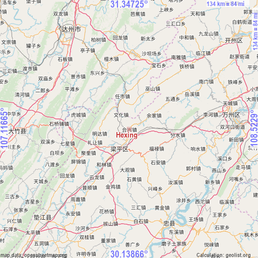
Hexing GPS coordinates[2]
30° 44' 41.46" North, 107° 49' 11.172" East
| Map corner | latitude | longitude |
|---|---|---|
| Upper-left | 31.34725°, | 107.11665° |
| Center: | 30.74485°, | 107.81977° |
| Lower-right: | 30.13866°, | 108.5229° |
| Map W x H: | 134.4×134.4 km | = 83.5×83.5mi |
| max Lat: | 53.31946° ⇑47.5% North |
| Hexing: | 30.74485° |
| min Lat: | ⇓52.5% South 18.22056° |
| min Long | Hexing | max Long |
| 75.07348° | 107.81977° | 134.28917° |
| W 18.8%⇐ | ⇒81.2% E |
Elevation
Elevation of Hexing is 445 m = 1460 ft, and this is 39.8 m = 131 ft below average elevation for this country.
| Max E: |
5622 m = 18445 ft | 28.3% |
| Avg. | 484.8 m = 1591 ft | |
| Hexing | 445 m = 1460 ft | |
Min E: |
-3 m = -10 ft | 71.7% |
See also: China elevation on elevation.city.
Geographical zone
Hexing is located in North temperate zone (between Tropic of Cancer and the Arctic Circle). Distance of this Northern Tropic circle is 812.6 km =504.9 mi to South.| Distance of | km | miles | from Hexing |
|---|---|---|---|
| North Pole | 6588.6 | 4094 | to North |
| Arctic Circle | 3982.7 | 2474.7 | to North |
| Tropic Cancer | 812.6 | 504.9 | to South |
| Equator | 3418.5 | 2124.2 | to South |


Nearby cities:
15 places around Hexing: (largest is in red/bold)
• Ansheng
11.2 km =7 mi,  237°
237°
• Baijia
18.7 km =11.6 mi,  154°
154°
• Chengbei
4.3 km =2.7 mi,  231°
231°
• Chengdong
7.4 km =4.6 mi,  111°
111°
• Fulu
17.4 km =10.8 mi,  125°
125°
• Lirang
19.2 km =11.9 mi,  249°
249°
• Longmen
14 km =8.7 mi,  295°
295°
• Mingda
15.7 km =9.8 mi,  262°
262°
• Panlong
12.6 km =7.8 mi,  166°
166°
• Renxian
16.4 km =10.2 mi, 235°
• Sunjia
18.6 km =11.6 mi,  95°
95°
• Wenhua
8.9 km =5.5 mi,  330°
330°
• Xiaping
6.5 km =4 mi,  62°
62°
• Xinsheng
14.3 km =8.9 mi,  320°
320°
• Yujia
14.8 km =9.2 mi, 59°
Sources, notices
• [Note1] Compared only with cities in China existing in our database
• [Src1] Map data: © OpenStreetMap contributors (CC-BY-SA)
• [Src2] Other city data from geonames.org with taken over terms of usage.
• [Src3] Geographical zone / Annual Mean Temperature by Robert A. Rohde @ Wikipedia
