Renqiu geodata
Renqiu (Hebei) is a populated place; located in China in Asia/Shanghai (GMT+8) time zone. With population of 98,569 people, there are 431 cities with bigger population in this country. Compared to other cities in China, 82.1% of cities are located further ↓South; 60.6% of cities are located further ←West and 86.9% of cities have higher elevation than Renqiu. Note1


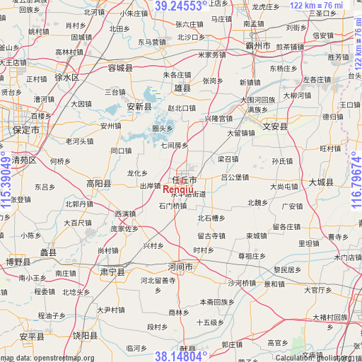
Renqiu GPS coordinates[2]
38° 41' 56.004" North, 116° 5' 36.996" East
| Map corner | latitude | longitude |
|---|---|---|
| Upper-left | 39.24553°, | 115.39049° |
| Center: | 38.69889°, | 116.09361° |
| Lower-right: | 38.14804°, | 116.79674° |
| Map W x H: | 122×122 km | = 75.8×75.8mi |
| max Lat: | 53.31946° ⇑17.9% North |
| Renqiu: | 38.69889° |
| min Lat: | ⇓82.1% South 18.22056° |
| min Long | Renqiu | max Long |
| 75.07348° | 116.09361° | 134.28917° |
| W 60.6%⇐ | ⇒39.4% E |
Elevation
Elevation of Renqiu is 13 m = 43 ft, and this is 471.8 m = 1548 ft below average elevation for this country.
| Max E: |
5622 m = 18445 ft | 86.9% |
| Avg. | 484.8 m = 1591 ft | |
| Renqiu | 13 m = 43 ft | |
Min E: |
-3 m = -10 ft | 13.1% |
See also: Renqiu elevation on elevation.city.
Geographical zone
Renqiu is located in North temperate zone (between Tropic of Cancer and the Arctic Circle). Distance of this Northern Tropic circle is 1697 km =1054.5 mi to South.| Distance of | km | miles | from Renqiu |
|---|---|---|---|
| North Pole | 5704.1 | 3544.4 | to North |
| Arctic Circle | 3098.3 | 1925.2 | to North |
| Tropic Cancer | 1697 | 1054.5 | to South |
| Equator | 4302.9 | 2673.7 | to South |


Nearby cities:
15 places around Renqiu: (largest is in red/bold)
• Baoding
55 km =34.2 mi,  287°
287°
• Botou
81.5 km =50.6 mi,  149°
149°
• Caigongzhuang
85.8 km =53.3 mi,  83°
83°
• Cangzhou
79.6 km =49.5 mi,  122°
122°
• Chenguantun
71.7 km =44.6 mi, 79°
• Dafengdui
81.8 km =50.8 mi,  74°
74°
• Daqiuzhuang
84.5 km =52.5 mi, 79°
• Duancun
49.6 km =30.8 mi,  189°
189°
• Duliu
79.4 km =49.3 mi,  62°
62°
• Jinghai
76.8 km =47.7 mi, 70°
• Liangwangzhuang
83.4 km =51.8 mi, 64°
• Shuangtang
72.8 km =45.2 mi, 74°
• Wangqingtuo
88 km =54.7 mi,  52°
52°
• Xizhaizhuang
79.2 km =49.2 mi, 84°
• Yangchengzhuang
87.1 km =54.1 mi, 71°
Sources, notices
• [Note1] Compared only with cities in China existing in our database
• [Src1] Map data: © OpenStreetMap contributors (CC-BY-SA)
• [Src2] Other city data from geonames.org with taken over terms of usage.
• [Src3] Geographical zone / Annual Mean Temperature by Robert A. Rohde @ Wikipedia
