Renheping geodata
Renheping (Hubei) is a seat of a fourth-order administrative division; located in China in Asia/Shanghai (GMT+8) time zone. In our database, there are 1268 cities with bigger population. Compared to other cities in China, 53% of cities are located further ↑North; 66.1% of cities are located further →East and 78.1% of cities have lower elevation than Renheping. Note1


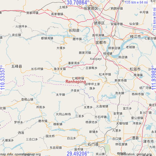
Renheping GPS coordinates[2]
30° 6' 7.992" North, 111° 14' 12.084" East
| Map corner | latitude | longitude |
|---|---|---|
| Upper-left | 30.70864°, | 110.53357° |
| Center: | 30.10222°, | 111.23669° |
| Lower-right: | 29.49206°, | 111.93982° |
| Map W x H: | 135.3×135.3 km | = 84.1×84.1mi |
| max Lat: | 53.31946° ⇑53% North |
| Renheping: | 30.10222° |
| min Lat: | ⇓47% South 18.22056° |
| min Long | Renheping | max Long |
| 75.07348° | 111.23669° | 134.28917° |
| W 33.9%⇐ | ⇒66.1% E |
Elevation
Elevation of Renheping is 617 m = 2024 ft, and this is 132.2 m = 434 ft above average elevation for this country.
| Max E: |
5622 m = 18445 ft | 21.9% |
| Renheping | 617 m 2024 ft | |
| Avg. | 484.8 m = 1591 ft | |
Min E: |
-3 m = -10 ft | 78.1% |
See also: China elevation on elevation.city.
Geographical zone
Renheping is located in North temperate zone (between Tropic of Cancer and the Arctic Circle). Distance of this Northern Tropic circle is 741.1 km =460.5 mi to South.| Distance of | km | miles | from Renheping |
|---|---|---|---|
| North Pole | 6660 | 4138.3 | to North |
| Arctic Circle | 4054.1 | 2519.1 | to North |
| Tropic Cancer | 741.1 | 460.5 | to South |
| Equator | 3347.1 | 2079.8 | to South |


Nearby cities:
15 places around Renheping: (largest is in red/bold)
• Dayan
30.2 km =18.8 mi,  330°
330°
• Ganxitan
29.3 km =18.2 mi,  152°
152°
• Huolianpo
32 km =19.9 mi,  139°
139°
• Liujiachang
23 km =14.3 mi,  101°
101°
• Niejiahe
23.2 km =14.4 mi,  14°
14°
• Panjiawan
13.7 km =8.5 mi,  344°
344°
• Sansheng
32.8 km =20.4 mi,  178°
178°
• Songmuping
23.6 km =14.7 mi,  81°
81°
• Taiping
20.7 km =12.9 mi,  227°
227°
• Taiqing
26.3 km =16.3 mi,  163°
163°
• Wangjiafan
14.8 km =9.2 mi,  52°
52°
• Wuyanquan
29.3 km =18.2 mi,  16°
16°
• Xiejiaping
14.3 km =8.9 mi,  118°
118°
• Yuyangguan
18 km =11.2 mi,  297°
297°
• Zilang
11.2 km =7 mi,  192°
192°
Sources, notices
• [Note1] Compared only with cities in China existing in our database
• [Src1] Map data: © OpenStreetMap contributors (CC-BY-SA)
• [Src2] Other city data from geonames.org with taken over terms of usage.
• [Src3] Geographical zone / Annual Mean Temperature by Robert A. Rohde @ Wikipedia
