Liujiachang geodata
Liujiachang (Hubei) is a seat of a fourth-order administrative division; located in China in Asia/Shanghai (GMT+8) time zone. In our database, there are 1268 cities with bigger population. Compared to other cities in China, 53.4% of cities are located further ↑North; 65.1% of cities are located further →East and 50.9% of cities have higher elevation than Liujiachang. Note1


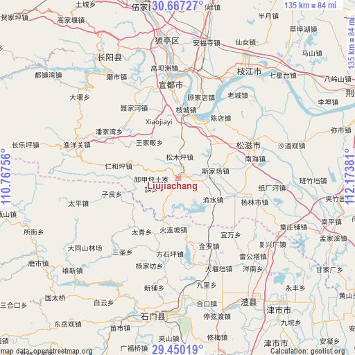
Liujiachang GPS coordinates[2]
30° 3' 38.16" North, 111° 28' 14.448" East
| Map corner | latitude | longitude |
|---|---|---|
| Upper-left | 30.66727°, | 110.76756° |
| Center: | 30.0606°, | 111.47068° |
| Lower-right: | 29.45019°, | 112.17381° |
| Map W x H: | 135.3×135.3 km | = 84.1×84.1mi |
| max Lat: | 53.31946° ⇑53.4% North |
| Liujiachang: | 30.0606° |
| min Lat: | ⇓46.6% South 18.22056° |
| min Long | Liujiachang | max Long |
| 75.07348° | 111.47068° | 134.28917° |
| W 34.9%⇐ | ⇒65.1% E |
Elevation
Elevation of Liujiachang is 157 m = 515 ft, and this is 327.8 m = 1075 ft below average elevation for this country.
| Max E: |
5622 m = 18445 ft | 50.9% |
| Avg. | 484.8 m = 1591 ft | |
| Liujiachang | 157 m = 515 ft | |
Min E: |
-3 m = -10 ft | 49.1% |
See also: China elevation on elevation.city.
Geographical zone
Liujiachang is located in North temperate zone (between Tropic of Cancer and the Arctic Circle). Distance of this Northern Tropic circle is 736.5 km =457.6 mi to South.| Distance of | km | miles | from Liujiachang |
|---|---|---|---|
| North Pole | 6664.6 | 4141.2 | to North |
| Arctic Circle | 4058.7 | 2522 | to North |
| Tropic Cancer | 736.5 | 457.6 | to South |
| Equator | 3342.4 | 2076.9 | to South |


Nearby cities:
15 places around Liujiachang: (largest is in red/bold)
• Ganxitan
23.3 km =14.5 mi,  203°
203°
• Huolianpo
19.7 km =12.2 mi,  184°
184°
• Jieheshi
24.1 km =15 mi,  102°
102°
• Renheping
23 km =14.3 mi,  281°
281°
• Sijiachang
14.8 km =9.2 mi,  78°
78°
• Songmuping
8.1 km =5 mi,  5°
5°
• Taiqing
25.6 km =15.9 mi,  216°
216°
• Wangjiafan
17.3 km =10.7 mi,  321°
321°
• Wangjiaqiao
21 km =13 mi,  66°
66°
• Wanjia
23.9 km =14.9 mi,  115°
115°
• Weishui
15.8 km =9.8 mi, 121°
• Xiejiaping
10.3 km =6.4 mi,  257°
257°
• Zhakou
23.4 km =14.5 mi,  172°
172°
• Zhicheng
26.3 km =16.3 mi, 7°
• Zilang
25.8 km =16 mi, 255°
Sources, notices
• [Note1] Compared only with cities in China existing in our database
• [Src1] Map data: © OpenStreetMap contributors (CC-BY-SA)
• [Src2] Other city data from geonames.org with taken over terms of usage.
• [Src3] Geographical zone / Annual Mean Temperature by Robert A. Rohde @ Wikipedia
