Quzi geodata
Quzi (Gansu) is a seat of a fourth-order administrative division; located in China in Asia/Shanghai (GMT+8) time zone. In our database, there are 1268 cities with bigger population. Compared to other cities in China, 77.8% of cities are located further ↓South; 82.2% of cities are located further →East and 87.7% of cities have lower elevation than Quzi. Note1


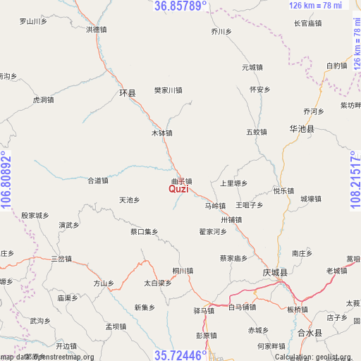
Quzi GPS coordinates[2]
36° 17' 35.628" North, 107° 30' 43.344" East
| Map corner | latitude | longitude |
|---|---|---|
| Upper-left | 36.85789°, | 106.80892° |
| Center: | 36.29323°, | 107.51204° |
| Lower-right: | 35.72446°, | 108.21517° |
| Map W x H: | 126×126 km | = 78.3×78.3mi |
| max Lat: | 53.31946° ⇑22.2% North |
| Quzi: | 36.29323° |
| min Lat: | ⇓77.8% South 18.22056° |
| min Long | Quzi | max Long |
| 75.07348° | 107.51204° | 134.28917° |
| W 17.8%⇐ | ⇒82.2% E |
Elevation
Elevation of Quzi is 1158 m = 3799 ft, and this is 673.2 m = 2209 ft above average elevation for this country.
| Max E: |
5622 m = 18445 ft | 12.3% |
| Quzi | 1158 m 3799 ft | |
| Avg. | 484.8 m = 1591 ft | |
Min E: |
-3 m = -10 ft | 87.7% |
See also: China elevation on elevation.city.
Geographical zone
Quzi is located in North temperate zone (between Tropic of Cancer and the Arctic Circle). Distance of this Northern Tropic circle is 1429.5 km =888.2 mi to South.| Distance of | km | miles | from Quzi |
|---|---|---|---|
| North Pole | 5971.6 | 3710.6 | to North |
| Arctic Circle | 3365.7 | 2091.3 | to North |
| Tropic Cancer | 1429.5 | 888.2 | to South |
| Equator | 4035.4 | 2507.5 | to South |


Nearby cities:
15 places around Quzi: (largest is in red/bold)
• Bazhu
29.6 km =18.4 mi,  10°
10°
• Binglincha
30.8 km =19.1 mi,  203°
203°
• Caikouji
21.7 km =13.5 mi,  215°
215°
• Dijiahe
20.5 km =12.7 mi,  148°
148°
• Hedao
29.1 km =18.1 mi,  270°
270°
• Liliangzi
29.1 km =18.1 mi,  70°
70°
• Maling
14.5 km =9 mi,  125°
125°
• Mubo
18.3 km =11.4 mi,  338°
338°
• Shangliyuan
18.4 km =11.4 mi,  91°
91°
• Tianchi
19.1 km =11.9 mi,  250°
250°
• Tongchuan
30.9 km =19.2 mi,  179°
179°
• Wangzuizi
25 km =15.5 mi,  108°
108°
• Wuchengzi
30.9 km =19.2 mi,  225°
225°
• Wujiao
31.5 km =19.6 mi,  56°
56°
• Xujiahe
9.2 km =5.7 mi,  52°
52°
Sources, notices
• [Note1] Compared only with cities in China existing in our database
• [Src1] Map data: © OpenStreetMap contributors (CC-BY-SA)
• [Src2] Other city data from geonames.org with taken over terms of usage.
• [Src3] Geographical zone / Annual Mean Temperature by Robert A. Rohde @ Wikipedia
