Hedao geodata
Hedao (Gansu) is a seat of a fourth-order administrative division; located in China in Asia/Shanghai (GMT+8) time zone. In our database, there are 1268 cities with bigger population. Compared to other cities in China, 77.8% of cities are located further ↓South; 83.1% of cities are located further →East and 89.5% of cities have lower elevation than Hedao. Note1


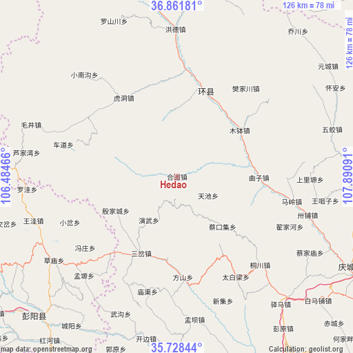
Hedao GPS coordinates[2]
36° 17' 49.848" North, 107° 11' 16.008" East
| Map corner | latitude | longitude |
|---|---|---|
| Upper-left | 36.86181°, | 106.48466° |
| Center: | 36.29718°, | 107.18778° |
| Lower-right: | 35.72844°, | 107.89091° |
| Map W x H: | 126×126 km | = 78.3×78.3mi |
| max Lat: | 53.31946° ⇑22.2% North |
| Hedao: | 36.29718° |
| min Lat: | ⇓77.8% South 18.22056° |
| min Long | Hedao | max Long |
| 75.07348° | 107.18778° | 134.28917° |
| W 16.9%⇐ | ⇒83.1% E |
Elevation
Elevation of Hedao is 1314 m = 4311 ft, and this is 829.2 m = 2720 ft above average elevation for this country.
| Max E: |
5622 m = 18445 ft | 10.5% |
| Hedao | 1314 m 4311 ft | |
| Avg. | 484.8 m = 1591 ft | |
Min E: |
-3 m = -10 ft | 89.5% |
See also: China elevation on elevation.city.
Geographical zone
Hedao is located in North temperate zone (between Tropic of Cancer and the Arctic Circle). Distance of this Northern Tropic circle is 1429.9 km =888.5 mi to South.| Distance of | km | miles | from Hedao |
|---|---|---|---|
| North Pole | 5971.2 | 3710.3 | to North |
| Arctic Circle | 3365.3 | 2091.1 | to North |
| Tropic Cancer | 1429.9 | 888.5 | to South |
| Equator | 4035.9 | 2507.8 | to South |


Nearby cities:
15 places around Hedao: (largest is in red/bold)
• Binglincha
33 km =20.5 mi,  149°
149°
• Caikouji
24.4 km =15.2 mi,  137°
137°
• Heping
7.7 km =4.8 mi,  302°
302°
• Huancheng
32.4 km =20.1 mi,  17°
17°
• Hudong
34 km =21.1 mi,  325°
325°
• Luping
13.3 km =8.3 mi, 298°
• Mubo
27.7 km =17.2 mi,  53°
53°
• Quzi
29.1 km =18.1 mi,  90°
90°
• Sancha
30.2 km =18.8 mi,  205°
205°
• Tianchi
13 km =8.1 mi,  121°
121°
• Wuchengzi
23.1 km =14.4 mi,  162°
162°
• Xichuan
22.3 km =13.9 mi,  351°
351°
• Xujiahe
36.7 km =22.8 mi,  81°
81°
• Yanwu
18.6 km =11.6 mi, 213°
• Yinjiacheng
25.2 km =15.7 mi,  241°
241°
Sources, notices
• [Note1] Compared only with cities in China existing in our database
• [Src1] Map data: © OpenStreetMap contributors (CC-BY-SA)
• [Src2] Other city data from geonames.org with taken over terms of usage.
• [Src3] Geographical zone / Annual Mean Temperature by Robert A. Rohde @ Wikipedia
