Wangzuizi geodata
Wangzuizi (Gansu) is a seat of a fourth-order administrative division; located in China in Asia/Shanghai (GMT+8) time zone. In our database, there are 1268 cities with bigger population. Compared to other cities in China, 77.7% of cities are located further ↓South; 81.3% of cities are located further →East and 87.8% of cities have lower elevation than Wangzuizi. Note1


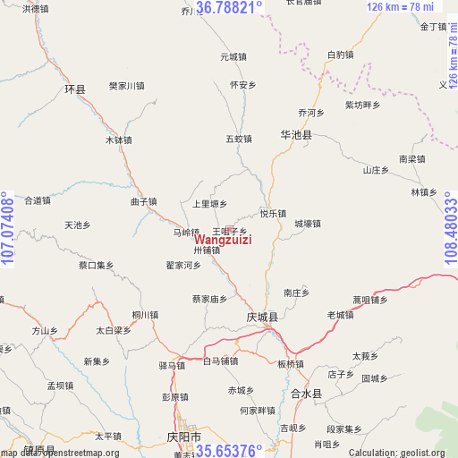
Wangzuizi GPS coordinates[2]
36° 13' 22.944" North, 107° 46' 37.92" East
| Map corner | latitude | longitude |
|---|---|---|
| Upper-left | 36.78821°, | 107.07408° |
| Center: | 36.22304°, | 107.7772° |
| Lower-right: | 35.65376°, | 108.48033° |
| Map W x H: | 126.1×126.1 km | = 78.4×78.4mi |
| max Lat: | 53.31946° ⇑22.3% North |
| Wangzuizi: | 36.22304° |
| min Lat: | ⇓77.7% South 18.22056° |
| min Long | Wangzuizi | max Long |
| 75.07348° | 107.7772° | 134.28917° |
| W 18.7%⇐ | ⇒81.3% E |
Elevation
Elevation of Wangzuizi is 1170 m = 3839 ft, and this is 685.2 m = 2248 ft above average elevation for this country.
| Max E: |
5622 m = 18445 ft | 12.2% |
| Wangzuizi | 1170 m 3839 ft | |
| Avg. | 484.8 m = 1591 ft | |
Min E: |
-3 m = -10 ft | 87.8% |
See also: China elevation on elevation.city.
Geographical zone
Wangzuizi is located in North temperate zone (between Tropic of Cancer and the Arctic Circle). Distance of this Northern Tropic circle is 1421.7 km =883.4 mi to South.| Distance of | km | miles | from Wangzuizi |
|---|---|---|---|
| North Pole | 5979.4 | 3715.4 | to North |
| Arctic Circle | 3373.5 | 2096.2 | to North |
| Tropic Cancer | 1421.7 | 883.4 | to South |
| Equator | 4027.6 | 2502.6 | to South |


Nearby cities:
15 places around Wangzuizi: (largest is in red/bold)
• Caijiamiao
19.5 km =12.1 mi,  195°
195°
• Dijiahe
16.2 km =10.1 mi,  233°
233°
• Liliangzi
18 km =11.2 mi,  11°
11°
• Maling
12 km =7.5 mi,  267°
267°
• Nanzhuang
25.1 km =15.6 mi,  133°
133°
• Qingcheng
26.8 km =16.7 mi,  158°
158°
• Quzi
25 km =15.5 mi,  288°
288°
• Rouyuan
32.2 km =20 mi,  34°
34°
• Sanshilipu
14 km =8.7 mi,  179°
179°
• Shangliyuan
9 km =5.6 mi,  323°
323°
• Wentai
19.6 km =12.2 mi,  36°
36°
• Wujiao
25.3 km =15.7 mi, 5°
• Xuanma
19.2 km =11.9 mi,  147°
147°
• Xujiahe
21.2 km =13.2 mi,  309°
309°
• Yuele
12.8 km =8 mi,  68°
68°
Sources, notices
• [Note1] Compared only with cities in China existing in our database
• [Src1] Map data: © OpenStreetMap contributors (CC-BY-SA)
• [Src2] Other city data from geonames.org with taken over terms of usage.
• [Src3] Geographical zone / Annual Mean Temperature by Robert A. Rohde @ Wikipedia
