Qingqu geodata
Qingqu (Hubei) is a seat of a fourth-order administrative division; located in China in Asia/Shanghai (GMT+8) time zone. In our database, there are 1268 cities with bigger population. Compared to other cities in China, 65.4% of cities are located further ↓South; 68.6% of cities are located further →East and 59.7% of cities have lower elevation than Qingqu. Note1


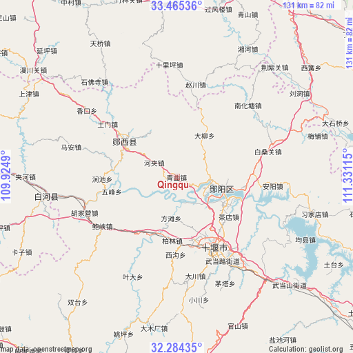
Qingqu GPS coordinates[2]
32° 52' 36.552" North, 110° 37' 40.872" East
| Map corner | latitude | longitude |
|---|---|---|
| Upper-left | 33.46536°, | 109.9249° |
| Center: | 32.87682°, | 110.62802° |
| Lower-right: | 32.28435°, | 111.33115° |
| Map W x H: | 131.3×131.3 km | = 81.6×81.6mi |
| max Lat: | 53.31946° ⇑34.6% North |
| Qingqu: | 32.87682° |
| min Lat: | ⇓65.4% South 18.22056° |
| min Long | Qingqu | max Long |
| 75.07348° | 110.62802° | 134.28917° |
| W 31.4%⇐ | ⇒68.6% E |
Elevation
Elevation of Qingqu is 256 m = 840 ft, and this is 228.8 m = 751 ft below average elevation for this country.
| Max E: |
5622 m = 18445 ft | 40.3% |
| Avg. | 484.8 m = 1591 ft | |
| Qingqu | 256 m = 840 ft | |
Min E: |
-3 m = -10 ft | 59.7% |
See also: China elevation on elevation.city.
Geographical zone
Qingqu is located in North temperate zone (between Tropic of Cancer and the Arctic Circle). Distance of this Northern Tropic circle is 1049.6 km =652.2 mi to South.| Distance of | km | miles | from Qingqu |
|---|---|---|---|
| North Pole | 6351.5 | 3946.6 | to North |
| Arctic Circle | 3745.6 | 2327.4 | to North |
| Tropic Cancer | 1049.6 | 652.2 | to South |
| Equator | 3655.6 | 2271.5 | to South |


Nearby cities:
15 places around Qingqu: (largest is in red/bold)
• Anjia
18.6 km =11.6 mi,  322°
322°
• Bailin
24.1 km =15 mi,  183°
183°
• Chadian
24.5 km =15.2 mi,  127°
127°
• Daliu
18.5 km =11.5 mi,  33°
33°
• Fangtan
15.5 km =9.6 mi,  185°
185°
• Guanyin
24.4 km =15.2 mi,  276°
276°
• Hanjianglu
26.7 km =16.6 mi,  144°
144°
• Hejia
10 km =6.2 mi,  301°
301°
• Huaguo
26.4 km =16.4 mi,  170°
170°
• Huanglong
22.4 km =13.9 mi,  195°
195°
• Liubei
14.3 km =8.9 mi,  123°
123°
• Wufeng
24.8 km =15.4 mi,  257°
257°
• Yangxipu
23.7 km =14.7 mi,  101°
101°
• Yunxian Chengguanzhen
17.6 km =10.9 mi,  106°
106°
• Yunxixian Chengguanzhen
22.5 km =14 mi, 301°
Sources, notices
• [Note1] Compared only with cities in China existing in our database
• [Src1] Map data: © OpenStreetMap contributors (CC-BY-SA)
• [Src2] Other city data from geonames.org with taken over terms of usage.
• [Src3] Geographical zone / Annual Mean Temperature by Robert A. Rohde @ Wikipedia
