Hejia geodata
Hejia (Hubei) is a seat of a fourth-order administrative division; located in China in Asia/Shanghai (GMT+8) time zone. In our database, there are 1268 cities with bigger population. Compared to other cities in China, 65.7% of cities are located further ↓South; 68.9% of cities are located further →East and 62.8% of cities have lower elevation than Hejia. Note1


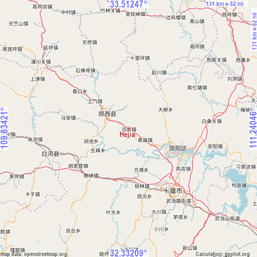
Hejia GPS coordinates[2]
32° 55' 27.3" North, 110° 32' 14.388" East
| Map corner | latitude | longitude |
|---|---|---|
| Upper-left | 33.51247°, | 109.83421° |
| Center: | 32.92425°, | 110.53733° |
| Lower-right: | 32.33209°, | 111.24046° |
| Map W x H: | 131.2×131.2 km | = 81.5×81.5mi |
| max Lat: | 53.31946° ⇑34.3% North |
| Hejia: | 32.92425° |
| min Lat: | ⇓65.7% South 18.22056° |
| min Long | Hejia | max Long |
| 75.07348° | 110.53733° | 134.28917° |
| W 31.1%⇐ | ⇒68.9% E |
Elevation
Elevation of Hejia is 293 m = 961 ft, and this is 191.8 m = 629 ft below average elevation for this country.
| Max E: |
5622 m = 18445 ft | 37.2% |
| Avg. | 484.8 m = 1591 ft | |
| Hejia | 293 m = 961 ft | |
Min E: |
-3 m = -10 ft | 62.8% |
See also: China elevation on elevation.city.
Geographical zone
Hejia is located in North temperate zone (between Tropic of Cancer and the Arctic Circle). Distance of this Northern Tropic circle is 1054.9 km =655.5 mi to South.| Distance of | km | miles | from Hejia |
|---|---|---|---|
| North Pole | 6346.2 | 3943.3 | to North |
| Arctic Circle | 3740.3 | 2324.1 | to North |
| Tropic Cancer | 1054.9 | 655.5 | to South |
| Equator | 3660.8 | 2274.7 | to South |


Nearby cities:
15 places around Hejia: (largest is in red/bold)
• Anjia
10 km =6.2 mi,  343°
343°
• Bailin
30.1 km =18.7 mi,  166°
166°
• Baoxia
30.9 km =19.2 mi,  218°
218°
• Daliu
21.2 km =13.2 mi,  61°
61°
• Fangtan
21.8 km =13.5 mi,  161°
161°
• Guanyin
16 km =9.9 mi,  260°
260°
• Huanglong
27 km =16.8 mi, 174°
• Hujiaying
30.8 km =19.1 mi,  238°
238°
• Jianchi
20.2 km =12.6 mi,  252°
252°
• Liubei
24.2 km =15 mi,  122°
122°
• Ma’an
31.4 km =19.5 mi,  280°
280°
• Qingqu
10 km =6.2 mi, 121°
• Wufeng
19 km =11.8 mi, 235°
• Yunxian Chengguanzhen
27.4 km =17 mi,  112°
112°
• Yunxixian Chengguanzhen
12.5 km =7.8 mi,  301°
301°
Sources, notices
• [Note1] Compared only with cities in China existing in our database
• [Src1] Map data: © OpenStreetMap contributors (CC-BY-SA)
• [Src2] Other city data from geonames.org with taken over terms of usage.
• [Src3] Geographical zone / Annual Mean Temperature by Robert A. Rohde @ Wikipedia
