Huanglong geodata
Huanglong (Hubei) is a seat of a fourth-order administrative division; located in China in Asia/Shanghai (GMT+8) time zone. In our database, there are 1268 cities with bigger population. Compared to other cities in China, 64.8% of cities are located further ↓South; 68.8% of cities are located further →East and 52.1% of cities have lower elevation than Huanglong. Note1


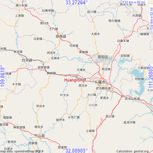
Huanglong GPS coordinates[2]
32° 40' 58.116" North, 110° 33' 53.712" East
| Map corner | latitude | longitude |
|---|---|---|
| Upper-left | 33.27264°, | 109.8618° |
| Center: | 32.68281°, | 110.56492° |
| Lower-right: | 32.08905°, | 111.26805° |
| Map W x H: | 131.6×131.6 km | = 81.8×81.8mi |
| max Lat: | 53.31946° ⇑35.2% North |
| Huanglong: | 32.68281° |
| min Lat: | ⇓64.8% South 18.22056° |
| min Long | Huanglong | max Long |
| 75.07348° | 110.56492° | 134.28917° |
| W 31.2%⇐ | ⇒68.8% E |
Elevation
Elevation of Huanglong is 182 m = 597 ft, and this is 302.8 m = 993 ft below average elevation for this country.
| Max E: |
5622 m = 18445 ft | 47.9% |
| Avg. | 484.8 m = 1591 ft | |
| Huanglong | 182 m = 597 ft | |
Min E: |
-3 m = -10 ft | 52.1% |
See also: China elevation on elevation.city.
Geographical zone
Huanglong is located in North temperate zone (between Tropic of Cancer and the Arctic Circle). Distance of this Northern Tropic circle is 1028.1 km =638.8 mi to South.| Distance of | km | miles | from Huanglong |
|---|---|---|---|
| North Pole | 6373.1 | 3960.1 | to North |
| Arctic Circle | 3767.2 | 2340.8 | to North |
| Tropic Cancer | 1028.1 | 638.8 | to South |
| Equator | 3634 | 2258.1 | to South |


Nearby cities:
15 places around Huanglong: (largest is in red/bold)
• Bailin
4.9 km =3 mi,  119°
119°
• Baoxia
22.1 km =13.7 mi,  277°
277°
• Chechenglu
18.7 km =11.6 mi,  105°
105°
• Dachuan
20.1 km =12.5 mi,  140°
140°
• Eryan
20.9 km =13 mi, 108°
• Fangtan
7.6 km =4.7 mi,  35°
35°
• Hanjianglu
21.3 km =13.2 mi,  90°
90°
• Huaguo
11.2 km =7 mi, 113°
• Liubei
22.6 km =14 mi,  52°
52°
• Qingqu
22.4 km =13.9 mi,  15°
15°
• Shiyan
20.3 km =12.6 mi,  101°
101°
• Wudanglu
24 km =14.9 mi, 114°
• Wufeng
24.4 km =15.2 mi,  311°
311°
• Xigou
9.3 km =5.8 mi,  147°
147°
• Yeda
18.8 km =11.7 mi,  213°
213°
Sources, notices
• [Note1] Compared only with cities in China existing in our database
• [Src1] Map data: © OpenStreetMap contributors (CC-BY-SA)
• [Src2] Other city data from geonames.org with taken over terms of usage.
• [Src3] Geographical zone / Annual Mean Temperature by Robert A. Rohde @ Wikipedia
