Pingdu geodata
Pingdu (Shandong) is a populated place; located in China in Asia/Shanghai (GMT+8) time zone. With population of 91,077 people, there are 465 cities with bigger population in this country. Compared to other cities in China, 78.7% of cities are located further ↓South; 81.6% of cities are located further ←West and 68.2% of cities have higher elevation than Pingdu. Note1


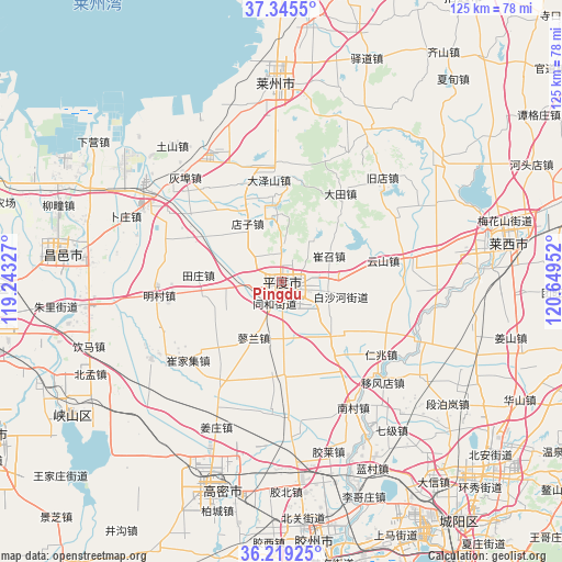
Pingdu GPS coordinates[2]
36° 47' 3.984" North, 119° 56' 47.004" East
| Map corner | latitude | longitude |
|---|---|---|
| Upper-left | 37.3455°, | 119.24327° |
| Center: | 36.78444°, | 119.94639° |
| Lower-right: | 36.21925°, | 120.64952° |
| Map W x H: | 125.2×125.2 km | = 77.8×77.8mi |
| max Lat: | 53.31946° ⇑21.3% North |
| Pingdu: | 36.78444° |
| min Lat: | ⇓78.7% South 18.22056° |
| min Long | Pingdu | max Long |
| 75.07348° | 119.94639° | 134.28917° |
| W 81.6%⇐ | ⇒18.4% E |
Elevation
Elevation of Pingdu is 59 m = 194 ft, and this is 425.8 m = 1397 ft below average elevation for this country.
| Max E: |
5622 m = 18445 ft | 68.2% |
| Avg. | 484.8 m = 1591 ft | |
| Pingdu | 59 m = 194 ft | |
Min E: |
-3 m = -10 ft | 31.8% |
See also: Pingdu elevation on elevation.city.
Geographical zone
Pingdu is located in North temperate zone (between Tropic of Cancer and the Arctic Circle). Distance of this Northern Tropic circle is 1484.1 km =922.2 mi to South.| Distance of | km | miles | from Pingdu |
|---|---|---|---|
| North Pole | 5917 | 3676.7 | to North |
| Arctic Circle | 3311.1 | 2057.4 | to North |
| Tropic Cancer | 1484.1 | 922.2 | to South |
| Equator | 4090 | 2541.4 | to South |


Nearby cities:
15 places around Pingdu: (largest is in red/bold)
• Chengguo
48.9 km =30.4 mi,  4°
4°
• Gaomi
47.8 km =29.7 mi,  201°
201°
• Guojiadian
38.1 km =23.7 mi,  29°
29°
• Jiaozhou
55.9 km =34.7 mi,  174°
174°
• Kuiju
50 km =31.1 mi,  278°
278°
• Laixi
52.3 km =32.5 mi,  80°
80°
• Laizhou
44.1 km =27.4 mi,  359°
359°
• Longhuya
39.1 km =24.3 mi,  349°
349°
• Nanshu
43.5 km =27 mi,  52°
52°
• Shahe
32.4 km =20.1 mi,  330°
330°
• Tushan
38.6 km =24 mi,  321°
321°
• Wenfenglu
38 km =23.6 mi, 357°
• Xiaqiu
25.1 km =15.6 mi, 351°
• Yidao
53.2 km =33.1 mi,  21°
21°
• Zuocun
30.7 km =19.1 mi, 359°
Sources, notices
• [Note1] Compared only with cities in China existing in our database
• [Src1] Map data: © OpenStreetMap contributors (CC-BY-SA)
• [Src2] Other city data from geonames.org with taken over terms of usage.
• [Src3] Geographical zone / Annual Mean Temperature by Robert A. Rohde @ Wikipedia
