Ningchegu geodata
Ningchegu (Tianjin) is a populated place; located in China in Asia/Shanghai (GMT+8) time zone. With population of 6,074 people, there are 848 cities with bigger population in this country. Compared to other cities in China, 83.5% of cities are located further ↓South; 69.3% of cities are located further ←West and 97.2% of cities have higher elevation than Ningchegu. Note1


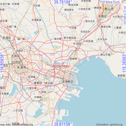
Ningchegu GPS coordinates[2]
39° 9' 32.004" North, 117° 39' 45" East
| Map corner | latitude | longitude |
|---|---|---|
| Upper-left | 39.70198°, | 116.95938° |
| Center: | 39.15889°, | 117.6625° |
| Lower-right: | 38.61158°, | 118.36563° |
| Map W x H: | 121.2×121.2 km | = 75.3×75.3mi |
| max Lat: | 53.31946° ⇑16.5% North |
| Ningchegu: | 39.15889° |
| min Lat: | ⇓83.5% South 18.22056° |
| min Long | Ningchegu | max Long |
| 75.07348° | 117.6625° | 134.28917° |
| W 69.3%⇐ | ⇒30.7% E |
Elevation
Elevation of Ningchegu is 5 m = 16 ft, and this is 479.8 m = 1574 ft below average elevation for this country.
| Max E: |
5622 m = 18445 ft | 97.2% |
| Avg. | 484.8 m = 1591 ft | |
| Ningchegu | 5 m = 16 ft | |
Min E: |
-3 m = -10 ft | 2.8% |
See also: China elevation on elevation.city.
Geographical zone
Ningchegu is located in North temperate zone (between Tropic of Cancer and the Arctic Circle). Distance of this Northern Tropic circle is 1748.1 km =1086.2 mi to South.| Distance of | km | miles | from Ningchegu |
|---|---|---|---|
| North Pole | 5653 | 3512.6 | to North |
| Arctic Circle | 3047.1 | 1893.4 | to North |
| Tropic Cancer | 1748.1 | 1086.2 | to South |
| Equator | 4354.1 | 2705.5 | to South |


Nearby cities:
15 places around Ningchegu: (largest is in red/bold)
• Beihuaidian
14 km =8.7 mi,  322°
322°
• Caijiapu
12.9 km =8 mi,  82°
82°
• Chadian
10.4 km =6.5 mi,  45°
45°
• Chengtougu
10.3 km =6.4 mi,  101°
101°
• Datianzhuang
14.9 km =9.3 mi,  31°
31°
• Duli
17.7 km =11 mi,  7°
7°
• Hangu
14.8 km =9.2 mi, 47°
• Qiaogu
17.9 km =11.1 mi,  17°
17°
• Qingtuozi
8.3 km =5.2 mi,  118°
118°
• Renfengzhuang
17 km =10.6 mi,  359°
359°
• Tanggu
15.4 km =9.6 mi,  185°
185°
• Wuxia
19.1 km =11.9 mi,  224°
224°
• Xinhe
13.7 km =8.5 mi, 194°
• Yonghe
18.6 km =11.6 mi,  240°
240°
• Zhongxinqiao
16.1 km =10 mi,  213°
213°
Sources, notices
• [Note1] Compared only with cities in China existing in our database
• [Src1] Map data: © OpenStreetMap contributors (CC-BY-SA)
• [Src2] Other city data from geonames.org with taken over terms of usage.
• [Src3] Geographical zone / Annual Mean Temperature by Robert A. Rohde @ Wikipedia
