Nianyushan geodata
Nianyushan (Jiangxi) is a seat of a fourth-order administrative division; located in China in Asia/Shanghai (GMT+8) time zone. In our database, there are 1268 cities with bigger population. Compared to other cities in China, 63.2% of cities are located further ↑North; 66.5% of cities are located further ←West and 78.8% of cities have higher elevation than Nianyushan. Note1


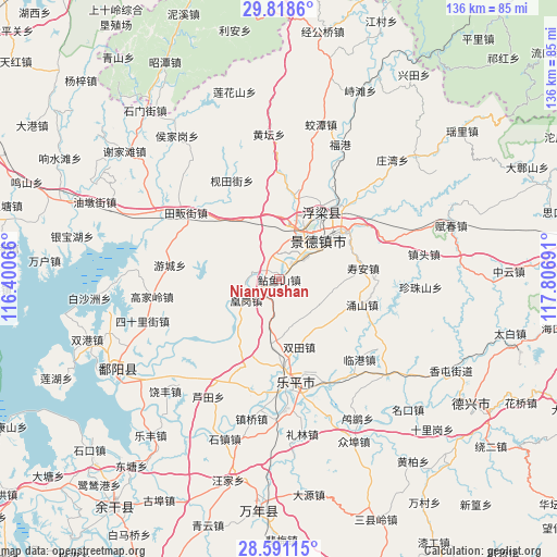
Nianyushan GPS coordinates[2]
29° 12' 24.156" North, 117° 6' 13.608" East
| Map corner | latitude | longitude |
|---|---|---|
| Upper-left | 29.8186°, | 116.40066° |
| Center: | 29.20671°, | 117.10378° |
| Lower-right: | 28.59115°, | 117.80691° |
| Map W x H: | 136.5×136.5 km | = 84.8×84.8mi |
| max Lat: | 53.31946° ⇑63.2% North |
| Nianyushan: | 29.20671° |
| min Lat: | ⇓36.8% South 18.22056° |
| min Long | Nianyushan | max Long |
| 75.07348° | 117.10378° | 134.28917° |
| W 66.5%⇐ | ⇒33.5% E |
Elevation
Elevation of Nianyushan is 29 m = 95 ft, and this is 455.8 m = 1495 ft below average elevation for this country.
| Max E: |
5622 m = 18445 ft | 78.8% |
| Avg. | 484.8 m = 1591 ft | |
| Nianyushan | 29 m = 95 ft | |
Min E: |
-3 m = -10 ft | 21.2% |
See also: China elevation on elevation.city.
Geographical zone
Nianyushan is located in North temperate zone (between Tropic of Cancer and the Arctic Circle). Distance of this Northern Tropic circle is 641.6 km =398.7 mi to South.| Distance of | km | miles | from Nianyushan |
|---|---|---|---|
| North Pole | 6759.6 | 4200.2 | to North |
| Arctic Circle | 4153.7 | 2581 | to North |
| Tropic Cancer | 641.6 | 398.7 | to South |
| Equator | 3247.5 | 2017.9 | to South |


Nearby cities:
15 places around Nianyushan: (largest is in red/bold)
• Dongxi
11.9 km =7.4 mi,  228°
228°
• Fuliang
23.4 km =14.5 mi,  36°
36°
• Hetang
4.7 km =2.9 mi,  133°
133°
• Hongyuan
13.6 km =8.5 mi,  19°
19°
• Huanggang
11.3 km =7 mi,  239°
239°
• Jingcheng
14.1 km =8.8 mi,  52°
52°
• Jingdezhen
14.1 km =8.8 mi, 45°
• Jinpanling
17.7 km =11 mi,  323°
323°
• Liyang
6.7 km =4.2 mi,  283°
283°
• Lümeng
9.6 km =6 mi, 43°
• Sanlong
20.3 km =12.6 mi,  11°
11°
• Shuangtian
17.4 km =10.8 mi,  163°
163°
• Taqian
16.2 km =10.1 mi,  187°
187°
• Xianghu
24.4 km =15.2 mi,  57°
57°
• Yongshan
21.4 km =13.3 mi,  107°
107°
Sources, notices
• [Note1] Compared only with cities in China existing in our database
• [Src1] Map data: © OpenStreetMap contributors (CC-BY-SA)
• [Src2] Other city data from geonames.org with taken over terms of usage.
• [Src3] Geographical zone / Annual Mean Temperature by Robert A. Rohde @ Wikipedia
