Shuangtian geodata
Shuangtian (Jiangxi) is a seat of a fourth-order administrative division; located in China in Asia/Shanghai (GMT+8) time zone. In our database, there are 1268 cities with bigger population. Compared to other cities in China, 64.8% of cities are located further ↑North; 66.8% of cities are located further ←West and 75.3% of cities have higher elevation than Shuangtian. Note1


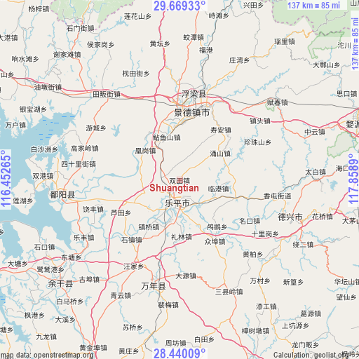
Shuangtian GPS coordinates[2]
29° 3' 23.544" North, 117° 9' 20.772" East
| Map corner | latitude | longitude |
|---|---|---|
| Upper-left | 29.66933°, | 116.45265° |
| Center: | 29.05654°, | 117.15577° |
| Lower-right: | 28.44009°, | 117.8589° |
| Map W x H: | 136.7×136.7 km | = 84.9×84.9mi |
| max Lat: | 53.31946° ⇑64.8% North |
| Shuangtian: | 29.05654° |
| min Lat: | ⇓35.2% South 18.22056° |
| min Long | Shuangtian | max Long |
| 75.07348° | 117.15577° | 134.28917° |
| W 66.8%⇐ | ⇒33.2% E |
Elevation
Elevation of Shuangtian is 36 m = 118 ft, and this is 448.8 m = 1472 ft below average elevation for this country.
| Max E: |
5622 m = 18445 ft | 75.3% |
| Avg. | 484.8 m = 1591 ft | |
| Shuangtian | 36 m = 118 ft | |
Min E: |
-3 m = -10 ft | 24.7% |
See also: China elevation on elevation.city.
Geographical zone
Shuangtian is located in North temperate zone (between Tropic of Cancer and the Arctic Circle). Distance of this Northern Tropic circle is 624.9 km =388.3 mi to South.| Distance of | km | miles | from Shuangtian |
|---|---|---|---|
| North Pole | 6776.3 | 4210.6 | to North |
| Arctic Circle | 4170.4 | 2591.4 | to North |
| Tropic Cancer | 624.9 | 388.3 | to South |
| Equator | 3230.8 | 2007.5 | to South |


Nearby cities:
15 places around Shuangtian: (largest is in red/bold)
• Dongxi
16.5 km =10.3 mi,  302°
302°
• Gaojia
22.9 km =14.2 mi,  105°
105°
• Hetang
13.6 km =8.5 mi,  352°
352°
• Huanggang
18.5 km =11.5 mi,  306°
306°
• Jiedu
11.9 km =7.4 mi,  174°
174°
• Leping
10.7 km =6.6 mi,  200°
200°
• Lilin
21.5 km =13.4 mi,  177°
177°
• Lingang
15.1 km =9.4 mi,  101°
101°
• Liyang
21.6 km =13.4 mi,  327°
327°
• Lusi
22.7 km =14.1 mi,  140°
140°
• Nianyushan
17.4 km =10.8 mi,  343°
343°
• Taqian
7.1 km =4.4 mi,  275°
275°
• Wukou
11.7 km =7.3 mi, 136°
• Yongshan
18.6 km =11.6 mi,  56°
56°
• Zhenqiao
21.1 km =13.1 mi,  213°
213°
Sources, notices
• [Note1] Compared only with cities in China existing in our database
• [Src1] Map data: © OpenStreetMap contributors (CC-BY-SA)
• [Src2] Other city data from geonames.org with taken over terms of usage.
• [Src3] Geographical zone / Annual Mean Temperature by Robert A. Rohde @ Wikipedia
