Nanrenfu geodata
Nanrenfu (Tianjin) is a populated place; located in China in Asia/Shanghai (GMT+8) time zone. With population of 3,365 people, there are 928 cities with bigger population in this country. Compared to other cities in China, 85.1% of cities are located further ↓South; 67.1% of cities are located further ←West and 95.9% of cities have higher elevation than Nanrenfu. Note1


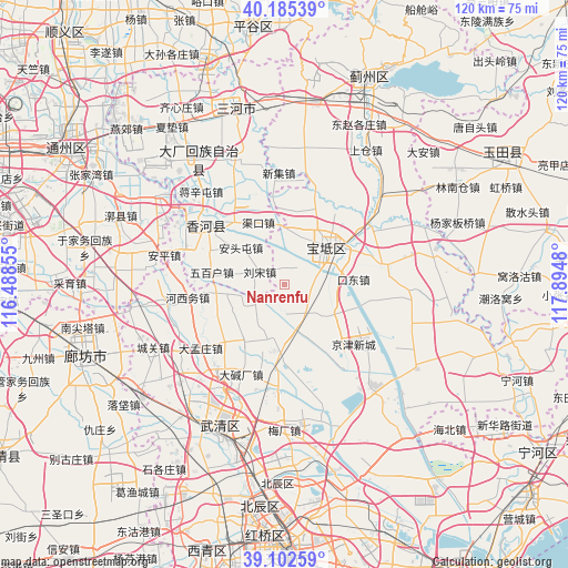
Nanrenfu GPS coordinates[2]
39° 38' 45.996" North, 117° 11' 30.012" East
| Map corner | latitude | longitude |
|---|---|---|
| Upper-left | 40.18539°, | 116.48855° |
| Center: | 39.64611°, | 117.19167° |
| Lower-right: | 39.10259°, | 117.8948° |
| Map W x H: | 120.4×120.4 km | = 74.8×74.8mi |
| max Lat: | 53.31946° ⇑14.9% North |
| Nanrenfu: | 39.64611° |
| min Lat: | ⇓85.1% South 18.22056° |
| min Long | Nanrenfu | max Long |
| 75.07348° | 117.19167° | 134.28917° |
| W 67.1%⇐ | ⇒32.9% E |
Elevation
Elevation of Nanrenfu is 6 m = 20 ft, and this is 478.8 m = 1571 ft below average elevation for this country.
| Max E: |
5622 m = 18445 ft | 95.9% |
| Avg. | 484.8 m = 1591 ft | |
| Nanrenfu | 6 m = 20 ft | |
Min E: |
-3 m = -10 ft | 4.1% |
See also: China elevation on elevation.city.
Geographical zone
Nanrenfu is located in North temperate zone (between Tropic of Cancer and the Arctic Circle). Distance of this Northern Tropic circle is 1802.3 km =1119.9 mi to South.| Distance of | km | miles | from Nanrenfu |
|---|---|---|---|
| North Pole | 5598.8 | 3478.9 | to North |
| Arctic Circle | 2992.9 | 1859.7 | to North |
| Tropic Cancer | 1802.3 | 1119.9 | to South |
| Equator | 4408.2 | 2739.1 | to South |


Nearby cities:
15 places around Nanrenfu: (largest is in red/bold)
• Cuihuangkou
13.4 km =8.3 mi,  184°
184°
• Dakoutun
7.7 km =4.8 mi,  155°
155°
• Daliang
14.5 km =9 mi,  214°
214°
• Hebeitun
10.4 km =6.5 mi,  220°
220°
• Houxiang
16.2 km =10.1 mi,  203°
203°
• Majiadian
6.5 km =4 mi,  78°
78°
• Niudaokou
16.4 km =10.2 mi,  18°
18°
• Niujiapai
16.1 km =10 mi,  148°
148°
• Shiqiao
10.2 km =6.3 mi,  60°
60°
• Xiawuqi
12.4 km =7.7 mi,  253°
253°
• Xinkaikou
3.6 km =2.2 mi,  358°
358°
• Yuguzhuang
14.3 km =8.9 mi,  92°
92°
• Zhaogezhuang
15.4 km =9.6 mi,  1°
1°
• Zhongdeng
15.1 km =9.4 mi,  114°
114°
• Zhuangtou
8.7 km =5.4 mi, 81°
Sources, notices
• [Note1] Compared only with cities in China existing in our database
• [Src1] Map data: © OpenStreetMap contributors (CC-BY-SA)
• [Src2] Other city data from geonames.org with taken over terms of usage.
• [Src3] Geographical zone / Annual Mean Temperature by Robert A. Rohde @ Wikipedia
