Nanmiao geodata
Nanmiao (Jiangxi) is a seat of a fourth-order administrative division; located in China in Asia/Shanghai (GMT+8) time zone. In our database, there are 1268 cities with bigger population. Compared to other cities in China, 75.8% of cities are located further ↑North; 51.1% of cities are located further ←West and 53.2% of cities have higher elevation than Nanmiao. Note1


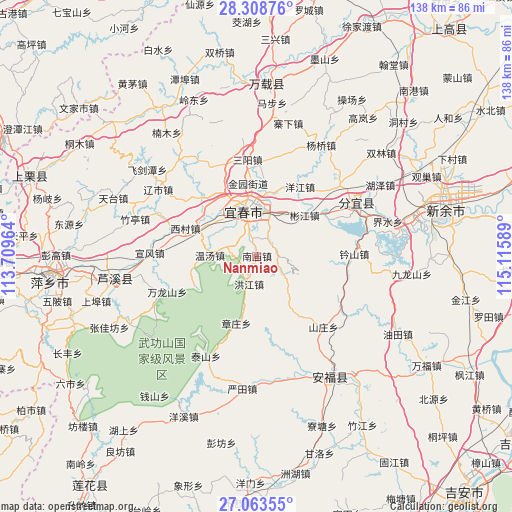
Nanmiao GPS coordinates[2]
27° 41' 16.548" North, 114° 24' 45.936" East
| Map corner | latitude | longitude |
|---|---|---|
| Upper-left | 28.30876°, | 113.70964° |
| Center: | 27.68793°, | 114.41276° |
| Lower-right: | 27.06355°, | 115.11589° |
| Map W x H: | 138.5×138.5 km | = 86.1×86.1mi |
| max Lat: | 53.31946° ⇑75.8% North |
| Nanmiao: | 27.68793° |
| min Lat: | ⇓24.2% South 18.22056° |
| min Long | Nanmiao | max Long |
| 75.07348° | 114.41276° | 134.28917° |
| W 51.1%⇐ | ⇒48.9% E |
Elevation
Elevation of Nanmiao is 142 m = 466 ft, and this is 342.8 m = 1125 ft below average elevation for this country.
| Max E: |
5622 m = 18445 ft | 53.2% |
| Avg. | 484.8 m = 1591 ft | |
| Nanmiao | 142 m = 466 ft | |
Min E: |
-3 m = -10 ft | 46.8% |
See also: China elevation on elevation.city.
Geographical zone
Nanmiao is located in North temperate zone (between Tropic of Cancer and the Arctic Circle). Distance of this Northern Tropic circle is 472.7 km =293.7 mi to South.| Distance of | km | miles | from Nanmiao |
|---|---|---|---|
| North Pole | 6928.5 | 4305.2 | to North |
| Arctic Circle | 4322.6 | 2685.9 | to North |
| Tropic Cancer | 472.7 | 293.7 | to South |
| Equator | 3078.6 | 1913 | to South |


Nearby cities:
15 places around Nanmiao: (largest is in red/bold)
• Binjiang
17.4 km =10.8 mi,  52°
52°
• Chuntai
13 km =8.1 mi,  347°
347°
• Dagangshan
17.6 km =10.9 mi,  101°
101°
• Hongjiang
7.8 km =4.8 mi,  194°
194°
• Hutian
16.3 km =10.1 mi,  336°
336°
• Wentang
12.5 km =7.8 mi,  272°
272°
• Wojiang
17.1 km =10.6 mi,  7°
7°
• Xiapu
12.4 km =7.7 mi, 13°
• Xicun
20.6 km =12.8 mi,  291°
291°
• Xinfang
5.8 km =3.6 mi,  76°
76°
• Xintian
21.5 km =13.4 mi,  315°
315°
• Yangjiang
22.2 km =13.8 mi,  32°
32°
• Yichun
16.2 km =10.1 mi,  355°
355°
• Yuanzhou
12.8 km =8 mi, 343°
• Zhangzhuang
18.7 km =11.6 mi,  196°
196°
Sources, notices
• [Note1] Compared only with cities in China existing in our database
• [Src1] Map data: © OpenStreetMap contributors (CC-BY-SA)
• [Src2] Other city data from geonames.org with taken over terms of usage.
• [Src3] Geographical zone / Annual Mean Temperature by Robert A. Rohde @ Wikipedia
