Nanlu geodata
Nanlu (Zhejiang) is a seat of a fourth-order administrative division; located in China in Asia/Shanghai (GMT+8) time zone. In our database, there are 1268 cities with bigger population. Compared to other cities in China, 51.5% of cities are located further ↓South; 81% of cities are located further ←West and 55.1% of cities have higher elevation than Nanlu. Note1


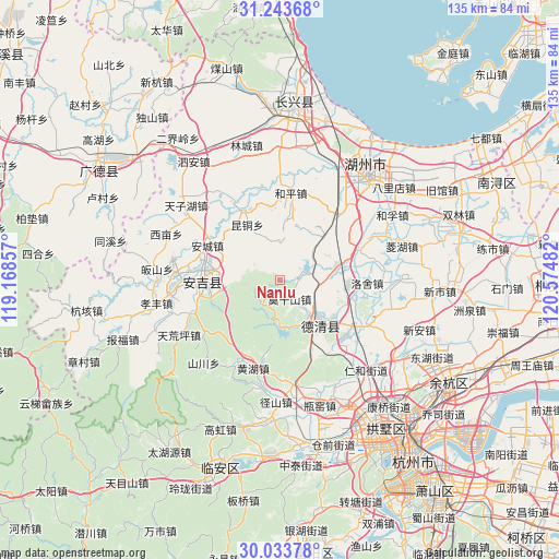
Nanlu GPS coordinates[2]
30° 38' 26.232" North, 119° 52' 18.084" East
| Map corner | latitude | longitude |
|---|---|---|
| Upper-left | 31.24368°, | 119.16857° |
| Center: | 30.64062°, | 119.87169° |
| Lower-right: | 30.03378°, | 120.57482° |
| Map W x H: | 134.5×134.5 km | = 83.6×83.6mi |
| max Lat: | 53.31946° ⇑48.5% North |
| Nanlu: | 30.64062° |
| min Lat: | ⇓51.5% South 18.22056° |
| min Long | Nanlu | max Long |
| 75.07348° | 119.87169° | 134.28917° |
| W 81%⇐ | ⇒19% E |
Elevation
Elevation of Nanlu is 131 m = 430 ft, and this is 353.8 m = 1161 ft below average elevation for this country.
| Max E: |
5622 m = 18445 ft | 55.1% |
| Avg. | 484.8 m = 1591 ft | |
| Nanlu | 131 m = 430 ft | |
Min E: |
-3 m = -10 ft | 44.9% |
See also: China elevation on elevation.city.
Geographical zone
Nanlu is located in North temperate zone (between Tropic of Cancer and the Arctic Circle). Distance of this Northern Tropic circle is 801 km =497.7 mi to South.| Distance of | km | miles | from Nanlu |
|---|---|---|---|
| North Pole | 6600.1 | 4101.1 | to North |
| Arctic Circle | 3994.3 | 2481.9 | to North |
| Tropic Cancer | 801 | 497.7 | to South |
| Equator | 3406.9 | 2116.9 | to South |


Nearby cities:
15 places around Nanlu: (largest is in red/bold)
• Baizhang
18.8 km =11.7 mi,  228°
228°
• Chengguan
22.4 km =13.9 mi,  117°
117°
• Daixi
13.5 km =8.4 mi,  79°
79°
• Deqing
13.6 km =8.5 mi,  141°
141°
• Fatou
10.7 km =6.6 mi,  190°
190°
• Heping
21.3 km =13.2 mi,  6°
6°
• Huanghu
22 km =13.7 mi,  196°
196°
• Kuntong
15.6 km =9.7 mi,  329°
329°
• Luniao
23.6 km =14.7 mi,  208°
208°
• Luoshe
20.8 km =12.9 mi,  91°
91°
• Miaoxi
20.2 km =12.6 mi,  38°
38°
• Moganshan
4.9 km =3 mi,  153°
153°
• Sanhe
23.6 km =14.7 mi, 139°
• Shuangxi
26.5 km =16.5 mi, 189°
• Wukang
13.8 km =8.6 mi, 142°
Sources, notices
• [Note1] Compared only with cities in China existing in our database
• [Src1] Map data: © OpenStreetMap contributors (CC-BY-SA)
• [Src2] Other city data from geonames.org with taken over terms of usage.
• [Src3] Geographical zone / Annual Mean Temperature by Robert A. Rohde @ Wikipedia
