Nancang geodata
Nancang (Tianjin) is a populated place; located in China in Asia/Shanghai (GMT+8) time zone. With population of 3,507 people, there are 923 cities with bigger population in this country. Compared to other cities in China, 83.8% of cities are located further ↓South; 66.6% of cities are located further ←West and 94.3% of cities have higher elevation than Nancang. Note1


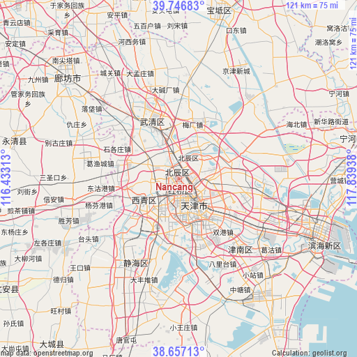
Nancang GPS coordinates[2]
39° 12' 14.724" North, 117° 8' 10.5" East
| Map corner | latitude | longitude |
|---|---|---|
| Upper-left | 39.74683°, | 116.43313° |
| Center: | 39.20409°, | 117.13625° |
| Lower-right: | 38.65713°, | 117.83938° |
| Map W x H: | 121.2×121.2 km | = 75.3×75.3mi |
| max Lat: | 53.31946° ⇑16.2% North |
| Nancang: | 39.20409° |
| min Lat: | ⇓83.8% South 18.22056° |
| min Long | Nancang | max Long |
| 75.07348° | 117.13625° | 134.28917° |
| W 66.6%⇐ | ⇒33.4% E |
Elevation
Elevation of Nancang is 7 m = 23 ft, and this is 477.8 m = 1568 ft below average elevation for this country.
| Max E: |
5622 m = 18445 ft | 94.3% |
| Avg. | 484.8 m = 1591 ft | |
| Nancang | 7 m = 23 ft | |
Min E: |
-3 m = -10 ft | 5.7% |
See also: China elevation on elevation.city.
Geographical zone
Nancang is located in North temperate zone (between Tropic of Cancer and the Arctic Circle). Distance of this Northern Tropic circle is 1753.2 km =1089.4 mi to South.| Distance of | km | miles | from Nancang |
|---|---|---|---|
| North Pole | 5648 | 3509.5 | to North |
| Arctic Circle | 3042.1 | 1890.3 | to North |
| Tropic Cancer | 1753.2 | 1089.4 | to South |
| Equator | 4359.1 | 2708.6 | to South |


Nearby cities:
15 places around Nancang: (largest is in red/bold)
• Beicang
3.7 km =2.3 mi,  341°
341°
• Dingzigu
3.8 km =2.4 mi,  151°
151°
• Guoyuan Xincun
2 km =1.2 mi,  345°
345°
• Hanjiashu
5.7 km =3.5 mi,  251°
251°
• Huayuandao
6.2 km =3.9 mi,  175°
175°
• Mazhuang
0.7 km =0.4 mi, 335°
• Santiaoshi
6.4 km =4 mi, 147°
• Shaogongzhuang
5.7 km =3.5 mi,  163°
163°
• Tiedonglu
5.5 km =3.4 mi,  106°
106°
• Wangqinzhuang
4.9 km =3 mi,  305°
305°
• Xianyang Beilu
2.3 km =1.4 mi,  171°
171°
• Xigu
5.2 km =3.2 mi, 147°
• Xinkaihe
4.8 km =3 mi,  131°
131°
• Xiyuzhuang
4.6 km =2.9 mi, 157°
• Yixingfu
6.5 km =4 mi,  94°
94°
Sources, notices
• [Note1] Compared only with cities in China existing in our database
• [Src1] Map data: © OpenStreetMap contributors (CC-BY-SA)
• [Src2] Other city data from geonames.org with taken over terms of usage.
• [Src3] Geographical zone / Annual Mean Temperature by Robert A. Rohde @ Wikipedia
