Meiyan geodata
Meiyan (Jiangsu) is a seat of a fourth-order administrative division; located in China in Asia/Shanghai (GMT+8) time zone. In our database, there are 1268 cities with bigger population. Compared to other cities in China, 54.6% of cities are located further ↓South; 85.6% of cities are located further ←West and 91.2% of cities have higher elevation than Meiyan. Note1


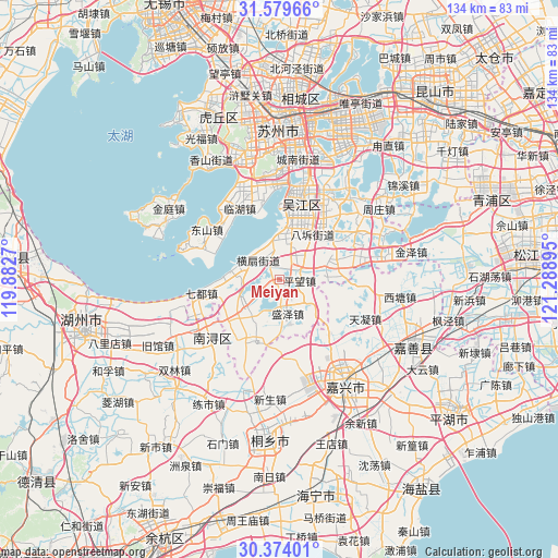
Meiyan GPS coordinates[2]
30° 58' 43.464" North, 120° 35' 8.952" East
| Map corner | latitude | longitude |
|---|---|---|
| Upper-left | 31.57966°, | 119.8827° |
| Center: | 30.97874°, | 120.58582° |
| Lower-right: | 30.37401°, | 121.28895° |
| Map W x H: | 134.1×134.1 km | = 83.3×83.3mi |
| max Lat: | 53.31946° ⇑45.4% North |
| Meiyan: | 30.97874° |
| min Lat: | ⇓54.6% South 18.22056° |
| min Long | Meiyan | max Long |
| 75.07348° | 120.58582° | 134.28917° |
| W 85.6%⇐ | ⇒14.4% E |
Elevation
Elevation of Meiyan is 9 m = 30 ft, and this is 475.8 m = 1561 ft below average elevation for this country.
| Max E: |
5622 m = 18445 ft | 91.2% |
| Avg. | 484.8 m = 1591 ft | |
| Meiyan | 9 m = 30 ft | |
Min E: |
-3 m = -10 ft | 8.8% |
See also: China elevation on elevation.city.
Geographical zone
Meiyan is located in North temperate zone (between Tropic of Cancer and the Arctic Circle). Distance of this Northern Tropic circle is 838.6 km =521.1 mi to South.| Distance of | km | miles | from Meiyan |
|---|---|---|---|
| North Pole | 6562.5 | 4077.7 | to North |
| Arctic Circle | 3956.7 | 2458.6 | to North |
| Tropic Cancer | 838.6 | 521.1 | to South |
| Equator | 3444.5 | 2140.3 | to South |


Nearby cities:
15 places around Meiyan: (largest is in red/bold)
• Dongshan
20.9 km =13 mi,  303°
303°
• Hengjing
22.1 km =13.7 mi,  346°
346°
• Hengshan
6.5 km =4 mi,  312°
312°
• Lili
11.7 km =7.3 mi,  81°
81°
• Linhu
20.6 km =12.8 mi,  323°
323°
• Nanxun
20 km =12.4 mi,  232°
232°
• Pingwang
4.8 km =3 mi,  92°
92°
• Qidou
19.1 km =11.9 mi,  261°
261°
• Shengze
11.1 km =6.9 mi,  134°
134°
• Songlong
21 km =13 mi,  13°
13°
• Taoyuan
19.8 km =12.3 mi,  205°
205°
• Taozhuang
21.1 km =13.1 mi, 92°
• Tianning
22.5 km =14 mi,  114°
114°
• Wangjiangjing
15.6 km =9.7 mi, 132°
• Zhenze
10.8 km =6.7 mi, 229°
Sources, notices
• [Note1] Compared only with cities in China existing in our database
• [Src1] Map data: © OpenStreetMap contributors (CC-BY-SA)
• [Src2] Other city data from geonames.org with taken over terms of usage.
• [Src3] Geographical zone / Annual Mean Temperature by Robert A. Rohde @ Wikipedia
