Shengze geodata
Shengze (Jiangsu) is a seat of a fourth-order administrative division; located in China in Asia/Shanghai (GMT+8) time zone. In our database, there are 1268 cities with bigger population. Compared to other cities in China, 54% of cities are located further ↓South; 86.1% of cities are located further ←West and 94.3% of cities have higher elevation than Shengze. Note1


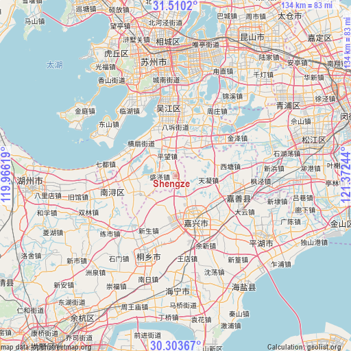
Shengze GPS coordinates[2]
30° 54' 31.824" North, 120° 40' 9.516" East
| Map corner | latitude | longitude |
|---|---|---|
| Upper-left | 31.5102°, | 119.96619° |
| Center: | 30.90884°, | 120.66931° |
| Lower-right: | 30.30367°, | 121.37244° |
| Map W x H: | 134.2×134.2 km | = 83.4×83.4mi |
| max Lat: | 53.31946° ⇑46% North |
| Shengze: | 30.90884° |
| min Lat: | ⇓54% South 18.22056° |
| min Long | Shengze | max Long |
| 75.07348° | 120.66931° | 134.28917° |
| W 86.1%⇐ | ⇒13.9% E |
Elevation
Elevation of Shengze is 7 m = 23 ft, and this is 477.8 m = 1568 ft below average elevation for this country.
| Max E: |
5622 m = 18445 ft | 94.3% |
| Avg. | 484.8 m = 1591 ft | |
| Shengze | 7 m = 23 ft | |
Min E: |
-3 m = -10 ft | 5.7% |
See also: China elevation on elevation.city.
Geographical zone
Shengze is located in North temperate zone (between Tropic of Cancer and the Arctic Circle). Distance of this Northern Tropic circle is 830.8 km =516.2 mi to South.| Distance of | km | miles | from Shengze |
|---|---|---|---|
| North Pole | 6570.3 | 4082.6 | to North |
| Arctic Circle | 3964.4 | 2463.4 | to North |
| Tropic Cancer | 830.8 | 516.2 | to South |
| Equator | 3436.7 | 2135.5 | to South |


Nearby cities:
15 places around Shengze: (largest is in red/bold)
• Hengshan
17.6 km =10.9 mi,  313°
313°
• Hongxi
16.1 km =10 mi,  89°
89°
• Jiabei
14.9 km =9.3 mi,  164°
164°
• Jiefang
17.1 km =10.6 mi,  148°
148°
• Lili
10.1 km =6.3 mi,  20°
20°
• Meiyan
11.1 km =6.9 mi, 314°
• Pingwang
8.2 km =5.1 mi,  337°
337°
• Qixing
17.3 km =10.7 mi,  127°
127°
• Tanghui
16 km =9.9 mi,  142°
142°
• Taozhuang
14.7 km =9.1 mi,  62°
62°
• Tianning
12.6 km =7.8 mi,  96°
96°
• Wangjiangjing
4.4 km =2.7 mi, 129°
• Yangmiao
15.5 km =9.6 mi,  112°
112°
• Youchegang
11.6 km =7.2 mi, 139°
• Zhenze
16.2 km =10.1 mi,  272°
272°
Sources, notices
• [Note1] Compared only with cities in China existing in our database
• [Src1] Map data: © OpenStreetMap contributors (CC-BY-SA)
• [Src2] Other city data from geonames.org with taken over terms of usage.
• [Src3] Geographical zone / Annual Mean Temperature by Robert A. Rohde @ Wikipedia
