Wuchuan geodata
Wuchuan (Guangdong) is a populated place; located in China in Asia/Urumqi (GMT+6) time zone. With population of 104,168 people, there are 418 cities with bigger population in this country. Compared to other cities in China, 98.2% of cities are located further ↑North; 68% of cities are located further →East and 94.3% of cities have higher elevation than Wuchuan. Note1


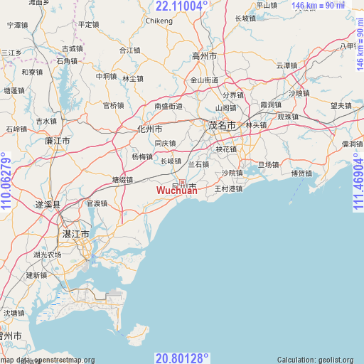
Wuchuan GPS coordinates[2]
21° 27' 25.668" North, 110° 45' 57.276" East
| Map corner | latitude | longitude |
|---|---|---|
| Upper-left | 22.11004°, | 110.06279° |
| Center: | 21.45713°, | 110.76591° |
| Lower-right: | 20.80128°, | 111.46904° |
| Map W x H: | 145.5×145.5 km | = 90.4×90.4mi |
| max Lat: | 53.31946° ⇑98.2% North |
| Wuchuan: | 21.45713° |
| min Lat: | ⇓1.8% South 18.22056° |
| min Long | Wuchuan | max Long |
| 75.07348° | 110.76591° | 134.28917° |
| W 32%⇐ | ⇒68% E |
Elevation
Elevation of Wuchuan is 7 m = 23 ft, and this is 477.8 m = 1568 ft below average elevation for this country.
| Max E: |
5622 m = 18445 ft | 94.3% |
| Avg. | 484.8 m = 1591 ft | |
| Wuchuan | 7 m = 23 ft | |
Min E: |
-3 m = -10 ft | 5.7% |
See also: Wuchuan elevation on elevation.city.
Geographical zone
Wuchuan is located in North Torrid zone (between Equator and Tropic of Cancer). Distance of this Northern Tropic circle is 220.1 km =136.8 mi to North.| Distance of | km | miles | from Wuchuan |
|---|---|---|---|
| North Pole | 7621.3 | 4735.7 | to North |
| Arctic Circle | 5015.4 | 3116.4 | to North |
| Tropic Cancer | 220.1 | 136.8 | to North |
| Equator | 2385.8 | 1482.5 | to South |


Nearby cities:
15 places around Wuchuan: (largest is in red/bold)
• Aotou
14.3 km =8.9 mi,  41°
41°
• Bopu
3.1 km =1.9 mi,  107°
107°
• Changqi
9.6 km =6 mi,  332°
332°
• Dashanjiang
4.5 km =2.8 mi,  134°
134°
• Haibin
6.7 km =4.2 mi,  164°
164°
• Lanshi
9.1 km =5.7 mi, 43°
• Meilu
2.7 km =1.7 mi, 158°
• Qianshui
14.3 km =8.9 mi,  354°
354°
• Tanba
9.3 km =5.8 mi,  97°
97°
• Tangwei
7.9 km =4.9 mi,  209°
209°
• Tongqing
16.9 km =10.5 mi, 333°
• Wuyang
14.6 km =9.1 mi, 213°
• Xiaoliang
13.5 km =8.4 mi,  72°
72°
• Zhangpu
7.3 km =4.5 mi,  265°
265°
• Zhenwen
10.1 km =6.3 mi,  236°
236°
Sources, notices
• [Note1] Compared only with cities in China existing in our database
• [Src1] Map data: © OpenStreetMap contributors (CC-BY-SA)
• [Src2] Other city data from geonames.org with taken over terms of usage.
• [Src3] Geographical zone / Annual Mean Temperature by Robert A. Rohde @ Wikipedia
