Maoping geodata
Maoping (Guizhou) is a populated place; located in China in Asia/Shanghai (GMT+8) time zone. With population of 1,123 people, there are 1149 cities with bigger population in this country. Compared to other cities in China, 79.6% of cities are located further ↑North; 75.3% of cities are located further →East and 66.4% of cities have lower elevation than Maoping. Note1


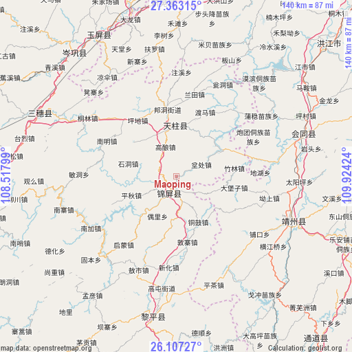
Maoping GPS coordinates[2]
26° 44' 12.984" North, 109° 13' 15.996" East
| Map corner | latitude | longitude |
|---|---|---|
| Upper-left | 27.36315°, | 108.51799° |
| Center: | 26.73694°, | 109.22111° |
| Lower-right: | 26.10727°, | 109.92424° |
| Map W x H: | 139.6×139.6 km | = 86.7×86.7mi |
| max Lat: | 53.31946° ⇑79.6% North |
| Maoping: | 26.73694° |
| min Lat: | ⇓20.4% South 18.22056° |
| min Long | Maoping | max Long |
| 75.07348° | 109.22111° | 134.28917° |
| W 24.7%⇐ | ⇒75.3% E |
Elevation
Elevation of Maoping is 351 m = 1152 ft, and this is 133.8 m = 439 ft below average elevation for this country.
| Max E: |
5622 m = 18445 ft | 33.6% |
| Avg. | 484.8 m = 1591 ft | |
| Maoping | 351 m = 1152 ft | |
Min E: |
-3 m = -10 ft | 66.4% |
See also: China elevation on elevation.city.
Geographical zone
Maoping is located in North temperate zone (between Tropic of Cancer and the Arctic Circle). Distance of this Northern Tropic circle is 367 km =228 mi to South.| Distance of | km | miles | from Maoping |
|---|---|---|---|
| North Pole | 7034.2 | 4370.8 | to North |
| Arctic Circle | 4428.3 | 2751.6 | to North |
| Tropic Cancer | 367 | 228 | to South |
| Equator | 2972.9 | 1847.3 | to South |


Nearby cities:
15 places around Maoping: (largest is in red/bold)
• Baishi
34.3 km =21.3 mi,  39°
39°
• Bangdong
26.8 km =16.7 mi,  352°
352°
• Benchu
7.9 km =4.9 mi,  61°
61°
• Dabaozi
23 km =14.3 mi,  101°
101°
• Dunzhai
26.5 km =16.5 mi,  170°
170°
• Gaoniang
12.5 km =7.8 mi,  340°
340°
• Jiangdong
36.3 km =22.6 mi, 39°
• Lantian
32.9 km =20.4 mi,  12°
12°
• Longlisuo
37.8 km =23.5 mi,  198°
198°
• Ouyang
35.3 km =21.9 mi,  180°
180°
• Qimeng
35.7 km =22.2 mi,  218°
218°
• Runsong
19.3 km =12 mi,  320°
320°
• Sanjiang
7.3 km =4.5 mi, 199°
• Tonggu
20.3 km =12.6 mi,  154°
154°
• Xinglong
29.2 km =18.1 mi,  49°
49°
Sources, notices
• [Note1] Compared only with cities in China existing in our database
• [Src1] Map data: © OpenStreetMap contributors (CC-BY-SA)
• [Src2] Other city data from geonames.org with taken over terms of usage.
• [Src3] Geographical zone / Annual Mean Temperature by Robert A. Rohde @ Wikipedia
