Gaoshibei geodata
Gaoshibei (Hubei) is a seat of a fourth-order administrative division; located in China in Asia/Shanghai (GMT+8) time zone. In our database, there are 1268 cities with bigger population. Compared to other cities in China, 50.8% of cities are located further ↓South; 59.2% of cities are located further →East and 76.2% of cities have higher elevation than Gaoshibei. Note1


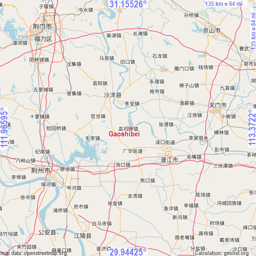
Gaoshibei GPS coordinates[2]
30° 33' 5.904" North, 112° 40' 8.652" East
| Map corner | latitude | longitude |
|---|---|---|
| Upper-left | 31.15526°, | 111.96595° |
| Center: | 30.55164°, | 112.66907° |
| Lower-right: | 29.94425°, | 113.3722° |
| Map W x H: | 134.7×134.7 km | = 83.7×83.7mi |
| max Lat: | 53.31946° ⇑49.2% North |
| Gaoshibei: | 30.55164° |
| min Lat: | ⇓50.8% South 18.22056° |
| min Long | Gaoshibei | max Long |
| 75.07348° | 112.66907° | 134.28917° |
| W 40.8%⇐ | ⇒59.2% E |
Elevation
Elevation of Gaoshibei is 34 m = 112 ft, and this is 450.8 m = 1479 ft below average elevation for this country.
| Max E: |
5622 m = 18445 ft | 76.2% |
| Avg. | 484.8 m = 1591 ft | |
| Gaoshibei | 34 m = 112 ft | |
Min E: |
-3 m = -10 ft | 23.8% |
See also: China elevation on elevation.city.
Geographical zone
Gaoshibei is located in North temperate zone (between Tropic of Cancer and the Arctic Circle). Distance of this Northern Tropic circle is 791.1 km =491.6 mi to South.| Distance of | km | miles | from Gaoshibei |
|---|---|---|---|
| North Pole | 6610 | 4107.3 | to North |
| Arctic Circle | 4004.2 | 2488.1 | to North |
| Tropic Cancer | 791.1 | 491.6 | to South |
| Equator | 3397 | 2110.8 | to South |


Nearby cities:
15 places around Gaoshibei: (largest is in red/bold)
• Duobao
13.3 km =8.3 mi,  8°
8°
• Guanghua
12.1 km =7.5 mi,  172°
172°
• Haokou
19.1 km =11.9 mi,  188°
188°
• Jiangchang
26.1 km =16.2 mi,  75°
75°
• Jiyukou
13.1 km =8.1 mi,  215°
215°
• Lishi
10.6 km =6.6 mi,  293°
293°
• Maoli
19.5 km =12.1 mi,  255°
255°
• Qianjiang
25.8 km =16 mi,  124°
124°
• Shayang
19.2 km =11.9 mi,  336°
336°
• Tuoshi
24.7 km =15.3 mi,  37°
37°
• Wangchang
10.6 km =6.6 mi, 117°
• Zekou
20.7 km =12.9 mi,  110°
110°
• Zhanggang
20 km =12.4 mi, 83°
• Zhouji
18.8 km =11.7 mi,  145°
145°
• Zhugentan
23.1 km =14.4 mi, 105°
Sources, notices
• [Note1] Compared only with cities in China existing in our database
• [Src1] Map data: © OpenStreetMap contributors (CC-BY-SA)
• [Src2] Other city data from geonames.org with taken over terms of usage.
• [Src3] Geographical zone / Annual Mean Temperature by Robert A. Rohde @ Wikipedia
