Quedantang geodata
Quedantang (Qinghai) is a seat of a fourth-order administrative division; located in China in Asia/Shanghai (GMT+8) time zone. In our database, there are 1268 cities with bigger population. Compared to other cities in China, 76.4% of cities are located further ↓South; 94.1% of cities are located further →East and 96.8% of cities have lower elevation than Quedantang. Note1


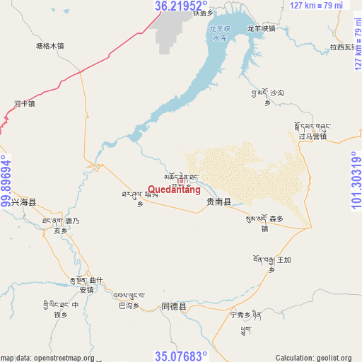
Quedantang GPS coordinates[2]
35° 39' 0.792" North, 100° 36' 0.216" East
| Map corner | latitude | longitude |
|---|---|---|
| Upper-left | 36.21952°, | 99.89694° |
| Center: | 35.65022°, | 100.60006° |
| Lower-right: | 35.07683°, | 101.30319° |
| Map W x H: | 127.1×127.1 km | = 79×79mi |
| max Lat: | 53.31946° ⇑23.6% North |
| Quedantang: | 35.65022° |
| min Lat: | ⇓76.4% South 18.22056° |
| min Long | Quedantang | max Long |
| 75.07348° | 100.60006° | 134.28917° |
| W 5.9%⇐ | ⇒94.1% E |
Elevation
Elevation of Quedantang is 2945 m = 9662 ft, and this is 2460.2 m = 8072 ft above average elevation for this country.
| Max E: |
5622 m = 18445 ft | 3.2% |
| Quedantang | 2945 m 9662 ft | |
| Avg. | 484.8 m = 1591 ft | |
Min E: |
-3 m = -10 ft | 96.8% |
See also: China elevation on elevation.city.
Geographical zone
Quedantang is located in North temperate zone (between Tropic of Cancer and the Arctic Circle). Distance of this Northern Tropic circle is 1358 km =843.8 mi to South.| Distance of | km | miles | from Quedantang |
|---|---|---|---|
| North Pole | 6043.1 | 3755 | to North |
| Arctic Circle | 3437.2 | 2135.8 | to North |
| Tropic Cancer | 1358 | 843.8 | to South |
| Equator | 3963.9 | 2463.1 | to South |


Nearby cities:
15 places around Quedantang: (largest is in red/bold)
• Bagou
45.7 km =28.4 mi,  203°
203°
• Gabasumdo
43.7 km =27.2 mi,  185°
185°
• Gomang
53 km =32.9 mi, 190°
• Guomaying
49.4 km =30.7 mi,  68°
68°
• Mangqu
15.5 km =9.6 mi,  117°
117°
• Nyinqug
54.2 km =33.7 mi,  154°
154°
• Qushi’an
49.1 km =30.5 mi,  222°
222°
• Sangdang
55 km =34.2 mi,  254°
254°
• Shagou
42.4 km =26.3 mi,  45°
45°
• Sumdo
33.5 km =20.8 mi, 115°
• Tanggan
52.4 km =32.6 mi, 198°
• Tangnaihai
45 km =28 mi, 250°
• Taxiu
15.5 km =9.6 mi, 247°
• Wangjia
43 km =26.7 mi,  131°
131°
• Ziketan
55.8 km =34.7 mi,  262°
262°
Sources, notices
• [Note1] Compared only with cities in China existing in our database
• [Src1] Map data: © OpenStreetMap contributors (CC-BY-SA)
• [Src2] Other city data from geonames.org with taken over terms of usage.
• [Src3] Geographical zone / Annual Mean Temperature by Robert A. Rohde @ Wikipedia
