Liushui geodata
Liushui (Fujian) is a seat of a fourth-order administrative division; located in China in Asia/Shanghai (GMT+8) time zone. In our database, there are 1268 cities with bigger population. Compared to other cities in China, 84% of cities are located further ↑North; 80.8% of cities are located further ←West and 86.2% of cities have higher elevation than Liushui. Note1


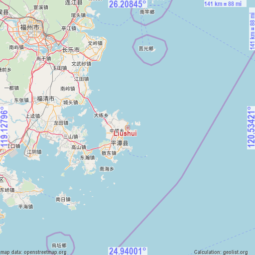
Liushui GPS coordinates[2]
25° 34' 33.276" North, 119° 49' 51.888" East
| Map corner | latitude | longitude |
|---|---|---|
| Upper-left | 26.20845°, | 119.12796° |
| Center: | 25.57591°, | 119.83108° |
| Lower-right: | 24.94001°, | 120.53421° |
| Map W x H: | 141×141 km | = 87.6×87.6mi |
| max Lat: | 53.31946° ⇑84% North |
| Liushui: | 25.57591° |
| min Lat: | ⇓16% South 18.22056° |
| min Long | Liushui | max Long |
| 75.07348° | 119.83108° | 134.28917° |
| W 80.8%⇐ | ⇒19.2% E |
Elevation
Elevation of Liushui is 14 m = 46 ft, and this is 470.8 m = 1545 ft below average elevation for this country.
| Max E: |
5622 m = 18445 ft | 86.2% |
| Avg. | 484.8 m = 1591 ft | |
| Liushui | 14 m = 46 ft | |
Min E: |
-3 m = -10 ft | 13.8% |
See also: China elevation on elevation.city.
Geographical zone
Liushui is located in North temperate zone (between Tropic of Cancer and the Arctic Circle). Distance of this Northern Tropic circle is 237.9 km =147.8 mi to South.| Distance of | km | miles | from Liushui |
|---|---|---|---|
| North Pole | 7163.3 | 4451.1 | to North |
| Arctic Circle | 4557.4 | 2831.8 | to North |
| Tropic Cancer | 237.9 | 147.8 | to South |
| Equator | 2843.8 | 1767.1 | to South |


Nearby cities:
15 places around Liushui: (largest is in red/bold)
• Aodong
17.1 km =10.6 mi,  216°
216°
• Aoqian
12.4 km =7.7 mi,  174°
174°
• Baiqing
10.5 km =6.5 mi,  322°
322°
• Beicuo
14.3 km =8.9 mi, 221°
• Dalian
16.2 km =10.1 mi,  296°
296°
• Donghan
27.7 km =17.2 mi,  234°
234°
• Dongxiang
5.5 km =3.4 mi,  67°
67°
• Gaoshan
29.8 km =18.5 mi,  247°
247°
• Lancheng
9 km =5.6 mi, 216°
• Luyang
7.4 km =4.6 mi,  278°
278°
• Nanhai
25 km =15.5 mi,  207°
207°
• Su’ao
13.2 km =8.2 mi,  289°
289°
• Tancheng
7.9 km =4.9 mi,  197°
197°
• Yutou
25.6 km =15.9 mi, 288°
• Zhonglou
6.1 km =3.8 mi,  256°
256°
Sources, notices
• [Note1] Compared only with cities in China existing in our database
• [Src1] Map data: © OpenStreetMap contributors (CC-BY-SA)
• [Src2] Other city data from geonames.org with taken over terms of usage.
• [Src3] Geographical zone / Annual Mean Temperature by Robert A. Rohde @ Wikipedia
