Yutou geodata
Yutou (Fujian) is a seat of a fourth-order administrative division; located in China in Asia/Shanghai (GMT+8) time zone. In our database, there are 1268 cities with bigger population. Compared to other cities in China, 83.7% of cities are located further ↑North; 79.4% of cities are located further ←West and 77.7% of cities have higher elevation than Yutou. Note1


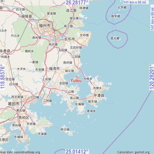
Yutou GPS coordinates[2]
25° 38' 58.668" North, 119° 35' 19.968" East
| Map corner | latitude | longitude |
|---|---|---|
| Upper-left | 26.28177°, | 118.88576° |
| Center: | 25.64963°, | 119.58888° |
| Lower-right: | 25.01412°, | 120.29201° |
| Map W x H: | 140.9×141 km | = 87.6×87.6mi |
| max Lat: | 53.31946° ⇑83.7% North |
| Yutou: | 25.64963° |
| min Lat: | ⇓16.3% South 18.22056° |
| min Long | Yutou | max Long |
| 75.07348° | 119.58888° | 134.28917° |
| W 79.4%⇐ | ⇒20.6% E |
Elevation
Elevation of Yutou is 31 m = 102 ft, and this is 453.8 m = 1489 ft below average elevation for this country.
| Max E: |
5622 m = 18445 ft | 77.7% |
| Avg. | 484.8 m = 1591 ft | |
| Yutou | 31 m = 102 ft | |
Min E: |
-3 m = -10 ft | 22.3% |
See also: China elevation on elevation.city.
Geographical zone
Yutou is located in North temperate zone (between Tropic of Cancer and the Arctic Circle). Distance of this Northern Tropic circle is 246.1 km =152.9 mi to South.| Distance of | km | miles | from Yutou |
|---|---|---|---|
| North Pole | 7155.1 | 4446 | to North |
| Arctic Circle | 4549.2 | 2826.7 | to North |
| Tropic Cancer | 246.1 | 152.9 | to South |
| Equator | 2852 | 1772.2 | to South |


Nearby cities:
15 places around Yutou: (largest is in red/bold)
• Baiqing
18 km =11.2 mi,  89°
89°
• Chengtou
9.4 km =5.8 mi,  307°
307°
• Dalian
9.8 km =6.1 mi,  96°
96°
• Gangtou
15.2 km =9.4 mi,  225°
225°
• Gaoshan
20.1 km =12.5 mi,  189°
189°
• Haikou
13.9 km =8.6 mi,  290°
290°
• Jiangjing
20 km =12.4 mi,  238°
238°
• Jiangtian
18.9 km =11.7 mi,  355°
355°
• Longtian
14.1 km =8.8 mi,  252°
252°
• Luyang
18.4 km =11.4 mi,  112°
112°
• Nanling
16.4 km =10.2 mi,  325°
325°
• Sanshan
14.7 km =9.1 mi,  209°
209°
• Songxia
12.7 km =7.9 mi,  2°
2°
• Su’ao
12.4 km =7.7 mi, 107°
• Zhonglou
20.8 km =12.9 mi,  117°
117°
Sources, notices
• [Note1] Compared only with cities in China existing in our database
• [Src1] Map data: © OpenStreetMap contributors (CC-BY-SA)
• [Src2] Other city data from geonames.org with taken over terms of usage.
• [Src3] Geographical zone / Annual Mean Temperature by Robert A. Rohde @ Wikipedia
