Lingtang geodata
Lingtang (Jiangsu) is a seat of a fourth-order administrative division; located in China in Asia/Shanghai (GMT+8) time zone. In our database, there are 1268 cities with bigger population. Compared to other cities in China, 64.8% of cities are located further ↓South; 77.2% of cities are located further ←West and 84.3% of cities have higher elevation than Lingtang. Note1


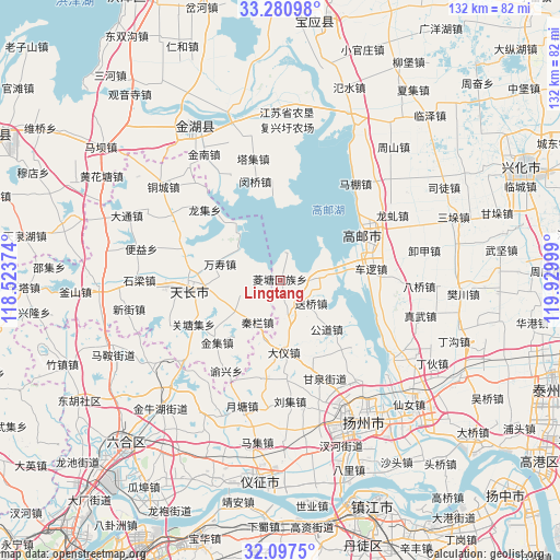
Lingtang GPS coordinates[2]
32° 41' 28.32" North, 119° 13' 36.696" East
| Map corner | latitude | longitude |
|---|---|---|
| Upper-left | 33.28098°, | 118.52374° |
| Center: | 32.6912°, | 119.22686° |
| Lower-right: | 32.0975°, | 119.92999° |
| Map W x H: | 131.6×131.6 km | = 81.8×81.8mi |
| max Lat: | 53.31946° ⇑35.2% North |
| Lingtang: | 32.6912° |
| min Lat: | ⇓64.8% South 18.22056° |
| min Long | Lingtang | max Long |
| 75.07348° | 119.22686° | 134.28917° |
| W 77.2%⇐ | ⇒22.8% E |
Elevation
Elevation of Lingtang is 17 m = 56 ft, and this is 467.8 m = 1535 ft below average elevation for this country.
| Max E: |
5622 m = 18445 ft | 84.3% |
| Avg. | 484.8 m = 1591 ft | |
| Lingtang | 17 m = 56 ft | |
Min E: |
-3 m = -10 ft | 15.7% |
See also: China elevation on elevation.city.
Geographical zone
Lingtang is located in North temperate zone (between Tropic of Cancer and the Arctic Circle). Distance of this Northern Tropic circle is 1029 km =639.4 mi to South.| Distance of | km | miles | from Lingtang |
|---|---|---|---|
| North Pole | 6372.1 | 3959.4 | to North |
| Arctic Circle | 3766.3 | 2340.3 | to North |
| Tropic Cancer | 1029 | 639.4 | to South |
| Equator | 3634.9 | 2258.6 | to South |


Nearby cities:
15 places around Lingtang: (largest is in red/bold)
• Cheluo
21.1 km =13.1 mi,  82°
82°
• Dayi
16.5 km =10.3 mi,  176°
176°
• Gaoyou
22.9 km =14.2 mi,  61°
61°
• Gongdao
16 km =9.9 mi,  135°
135°
• Guoji
9.4 km =5.8 mi,  85°
85°
• Jiepai
7.1 km =4.4 mi,  276°
276°
• Jinji
21 km =13 mi,  225°
225°
• Qinlan
11.5 km =7.1 mi,  209°
209°
• Renheji
12.7 km =7.9 mi,  235°
235°
• Songqiao
9 km =5.6 mi,  126°
126°
• Tianchang
20.4 km =12.7 mi,  268°
268°
• Tianshan
7.8 km =4.8 mi,  165°
165°
• Wanshou
14.4 km =8.9 mi,  285°
285°
• Yeshan
22.3 km =13.9 mi, 244°
• Yongfeng
22.4 km =13.9 mi, 281°
Sources, notices
• [Note1] Compared only with cities in China existing in our database
• [Src1] Map data: © OpenStreetMap contributors (CC-BY-SA)
• [Src2] Other city data from geonames.org with taken over terms of usage.
• [Src3] Geographical zone / Annual Mean Temperature by Robert A. Rohde @ Wikipedia
