Tianchang geodata
Tianchang (Anhui) is a seat of a third-order administrative division; located in China in Asia/Shanghai (GMT+8) time zone. In our database, there are 1268 cities with bigger population. Compared to other cities in China, 64.8% of cities are located further ↓South; 76.1% of cities are located further ←West and 86.2% of cities have higher elevation than Tianchang. Note1


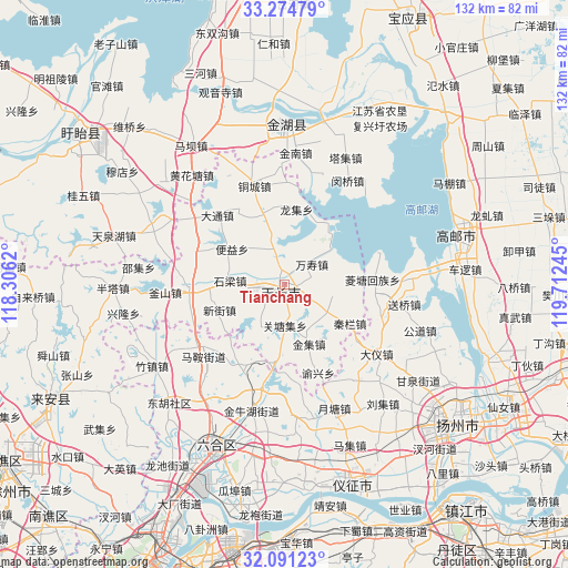
Tianchang GPS coordinates[2]
32° 41' 5.892" North, 119° 0' 33.552" East
| Map corner | latitude | longitude |
|---|---|---|
| Upper-left | 33.27479°, | 118.3062° |
| Center: | 32.68497°, | 119.00932° |
| Lower-right: | 32.09123°, | 119.71245° |
| Map W x H: | 131.6×131.6 km | = 81.8×81.8mi |
| max Lat: | 53.31946° ⇑35.2% North |
| Tianchang: | 32.68497° |
| min Lat: | ⇓64.8% South 18.22056° |
| min Long | Tianchang | max Long |
| 75.07348° | 119.00932° | 134.28917° |
| W 76.1%⇐ | ⇒23.9% E |
Elevation
Elevation of Tianchang is 14 m = 46 ft, and this is 470.8 m = 1545 ft below average elevation for this country.
| Max E: |
5622 m = 18445 ft | 86.2% |
| Avg. | 484.8 m = 1591 ft | |
| Tianchang | 14 m = 46 ft | |
Min E: |
-3 m = -10 ft | 13.8% |
See also: China elevation on elevation.city.
Geographical zone
Tianchang is located in North temperate zone (between Tropic of Cancer and the Arctic Circle). Distance of this Northern Tropic circle is 1028.3 km =639 mi to South.| Distance of | km | miles | from Tianchang |
|---|---|---|---|
| North Pole | 6372.8 | 3959.9 | to North |
| Arctic Circle | 3766.9 | 2340.6 | to North |
| Tropic Cancer | 1028.3 | 639 | to South |
| Equator | 3634.2 | 2258.2 | to South |


Nearby cities:
15 places around Tianchang: (largest is in red/bold)
• Chajian
22.5 km =14 mi,  267°
267°
• Datong
22.2 km =13.8 mi,  315°
315°
• Jiepai
13.4 km =8.3 mi,  83°
83°
• Jinji
15.1 km =9.4 mi,  158°
158°
• Lingtang
20.4 km =12.7 mi,  88°
88°
• Qinlan
17.4 km =10.8 mi,  122°
122°
• Renheji
11.9 km =7.4 mi, 123°
• Shiliang
12.7 km =7.9 mi, 273°
• Wanshou
8 km =5 mi,  54°
54°
• Xinjie
16.4 km =10.2 mi,  248°
248°
• Yangcun
12.1 km =7.5 mi,  345°
345°
• Yeshan
8.8 km =5.5 mi,  178°
178°
• Yeshan
21 km =13 mi,  205°
205°
• Yongfeng
5.4 km =3.4 mi,  342°
342°
• Zhengji
11.5 km =7.1 mi, 210°
Sources, notices
• [Note1] Compared only with cities in China existing in our database
• [Src1] Map data: © OpenStreetMap contributors (CC-BY-SA)
• [Src2] Other city data from geonames.org with taken over terms of usage.
• [Src3] Geographical zone / Annual Mean Temperature by Robert A. Rohde @ Wikipedia
